HammerHead4
Site:
HammerHead4
Downloads:
Map
3D Model:
Description:
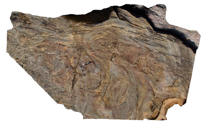
tightly folded gneiss with mafic zone that may represent dykes. Hammer Head, W.A south coast.
| Capture Date: | June 5, 2016, 10:46 a.m. |
| Latitude: | -33.94917000000 degrees |
| Longitude: | 122.57466000000 degrees |
| Elevation: | NA |
| Visualisation Type: | 3D |
| Location Accuracy: | 0 metres |
Keywords:
- tight fold
- gneiss
- structure
| gneiss | |
|---|---|
| Form Type: | |
| Description: | layered granitic? Gneiss with mafic enclaves. |
| Min Geological Age: | |
| Max Geological Age: | |
| Min Numerical Age: | 0.000 |
| Max Numerical Age: | 0.000 |
| Strat No: | 0 |
| Supergroup: | |
| Group: | |
| Subgroup: | |
| Formation: | |
| Member: | |
| Province: |
| mafic | |
|---|---|
| Form Type: | |
| Description: | undifferentiated mafic dyke units. Biotitic rock. |
| Min Geological Age: | |
| Max Geological Age: | |
| Min Numerical Age: | 0.000 |
| Max Numerical Age: | 0.000 |
| Strat No: | 0 |
| Supergroup: | |
| Group: | |
| Subgroup: | |
| Formation: | |
| Member: | |
| Province: |