HardyUAV1
Site:
HardyUAV1
Downloads:
Map
3D Model:
Description:
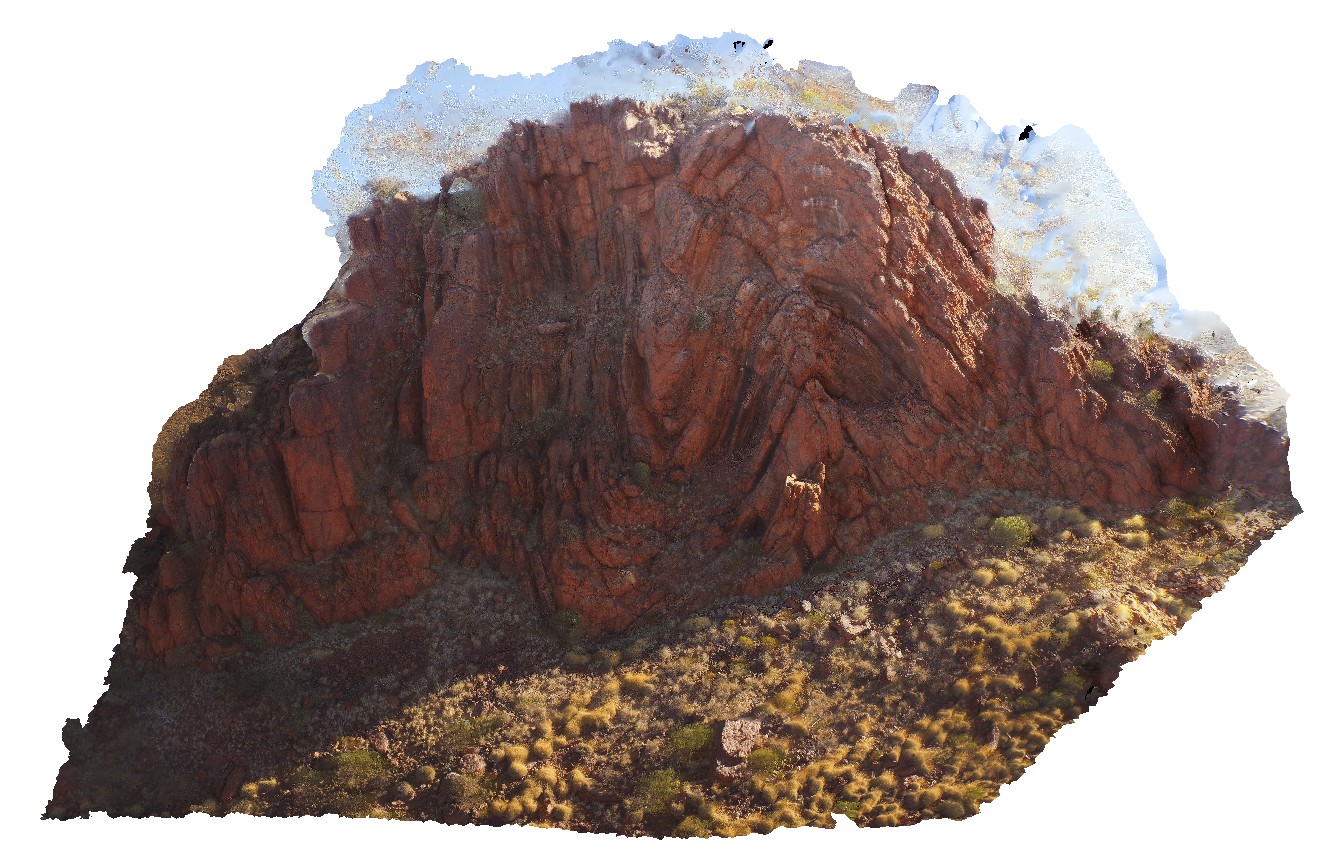
'M' folding in the Marra Mamba Iron Formation outcrop. Nanutarra Road, W.A.
| Capture Date: | May 28, 2016, noon |
| Latitude: | -22.95306990000 degrees |
| Longitude: | 117.31003260000 degrees |
| Elevation: | NA |
| Visualisation Type: | UAV |
| Location Accuracy: | 0 metres |
Keywords:
- M folding
- banded Iron Formation
- BIF
- structure
- folding
| BIF | |
|---|---|
| Form Type: | bedded |
| Description: | banded iron-formation?, minor shale, siltstone, mudstone. |
| Min Geological Age: | Neoarchean |
| Max Geological Age: | Neoarchean |
| Min Numerical Age: | 2596.000 |
| Max Numerical Age: | 2629.000 |
| Strat No: | 11353 |
| Supergroup: | Mount Bruce Supergroup |
| Group: | |
| Subgroup: | |
| Formation: | Marra Mamba Iron Formation |
| Member: | |
| Province: | Hamersley Basin |