Harveys13
Site:
Harveys13
Downloads:
Map
3D Model:
Description:
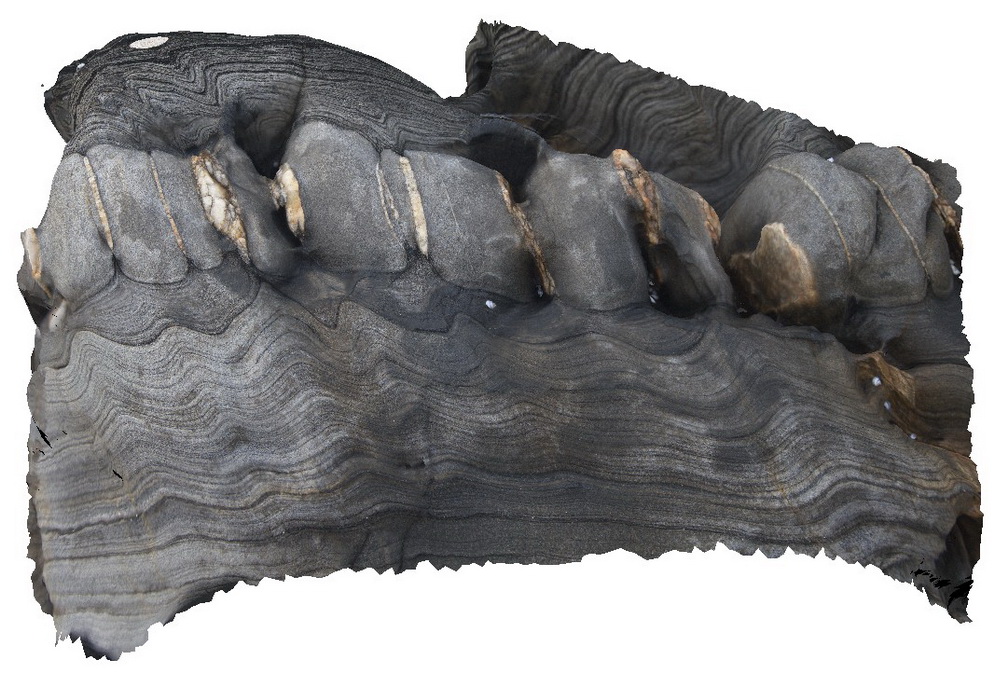
boudinaged clean/blocky sand layer with quartz veins and deformation in silty layers. Harvey's Bay, Kangaroo Island. S.A.
| Capture Date: | Nov. 17, 2015, 10:49 a.m. |
| Latitude: | -35.74693000000 degrees |
| Longitude: | 136.63998000000 degrees |
| Elevation: | NA |
| Visualisation Type: | 3D |
| Location Accuracy: | 0 metres |
Keywords:
- boudinage
- folding
- structure
- zebra rock
| sandstone | |
|---|---|
| Form Type: | bedded |
| Description: | fine to medium-grained, finely laminated grey / black and white, biotite?- metasandstone interbedded with thicker sandstone beds. |
| Min Geological Age: | Early Cambrian |
| Max Geological Age: | Early Cambrian |
| Min Numerical Age: | 509.000 |
| Max Numerical Age: | 541.000 |
| Strat No: | 25773 |
| Supergroup: | Moralana Supergroup |
| Group: | |
| Subgroup: | |
| Formation: | Balquhidder Formation |
| Member: | |
| Province: | Delamerian Orogen, Stansbury Basin |