Ironstone5
Site:
Ironstone5
Downloads:
Map
3D Model:
Description:
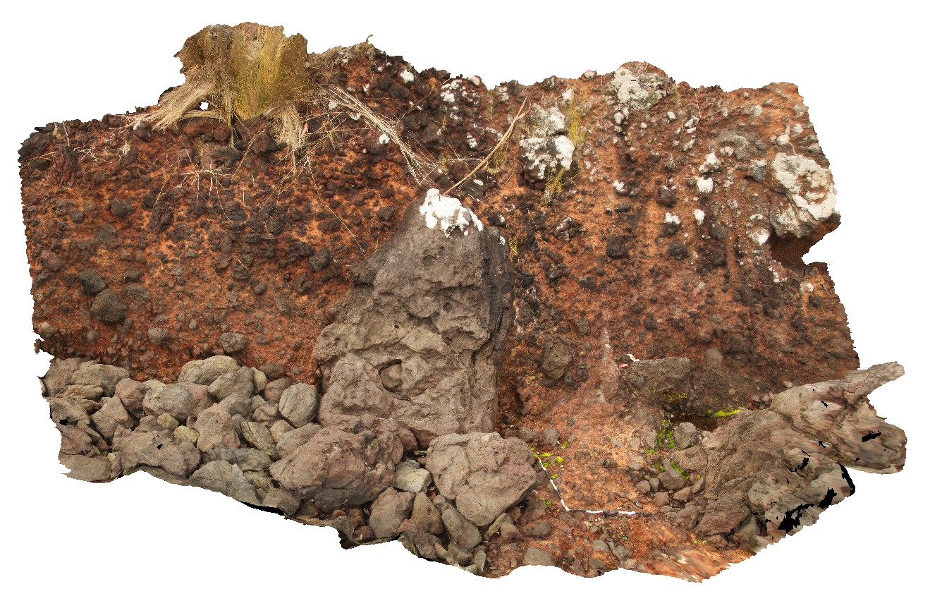
giant bomb in pyroclastic deposits. Ironstone Point, Tas.
| Capture Date: | Undated |
| Latitude: | -42.97054000000 degrees |
| Longitude: | 147.73294000000 degrees |
| Elevation: | NA |
| Visualisation Type: | 3D |
| Location Accuracy: | 5 metres |
Keywords:
- pyroclastic
- basalt
- volcanics
- bomb
- Tertiary basalt
| basalt | |
|---|---|
| Form Type: | pyroclastics |
| Description: | Volcanic rocks, predominantly mafic; basalt, trachyte, trachybasalt, trachyandesite, leucitite, basanite, nephelinite, limburgite, rhyolite, tuff and high level intrusives; rare volcaniclastic sediments |
| Min Geological Age: | Cenozoic |
| Max Geological Age: | Cenozoic |
| Min Numerical Age: | 0.012 |
| Max Numerical Age: | 66.000 |
| Strat No: | 38495 |
| Supergroup: | |
| Group: | |
| Subgroup: | |
| Formation: | mafic volcanic rocks 38495 |
| Member: | |
| Province: |