IrwinRiver12
Site:
IrwinRiver12
Downloads:
Map
3D Model:
Description:
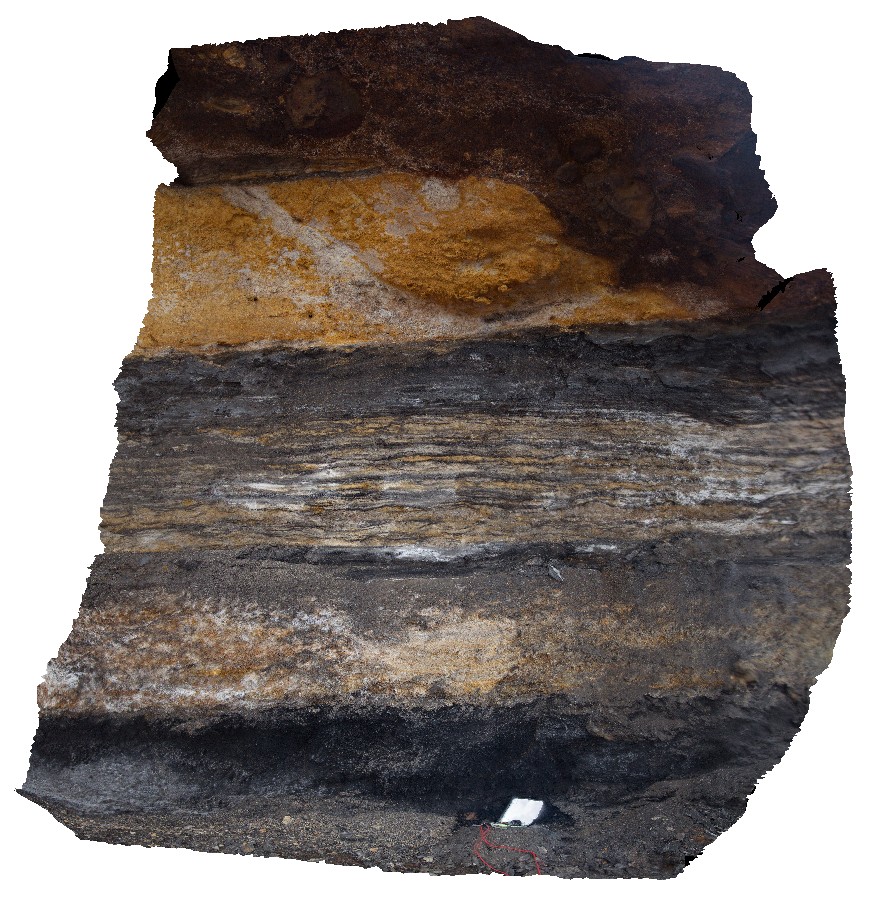
detailed section from the top of a coal seam, showing rippled laminations. Coal seam Conservation Park, Irwin River, W.A.
| Capture Date: | May 19, 2016, noon |
| Latitude: | -28.93731000000 degrees |
| Longitude: | 115.55065000000 degrees |
| Elevation: | NA |
| Visualisation Type: | 3D |
| Location Accuracy: | 0 metres |
Keywords:
- coal measure
- stratigraphical
| coal seam | |
|---|---|
| Form Type: | bedded |
| Description: | Fine grained quartz sandstone with interbedded coal layers. |
| Min Geological Age: | Artinskian |
| Max Geological Age: | Artinskian |
| Min Numerical Age: | 283.500 |
| Max Numerical Age: | 290.100 |
| Strat No: | 27166 |
| Supergroup: | |
| Group: | |
| Subgroup: | |
| Formation: | Irwin River Coal Measures |
| Member: | |
| Province: | Abrolhos Sub-basin, Dandaragan Trough, Dongara Terrace, Perth Basin, Southern Carnarvon Basin |