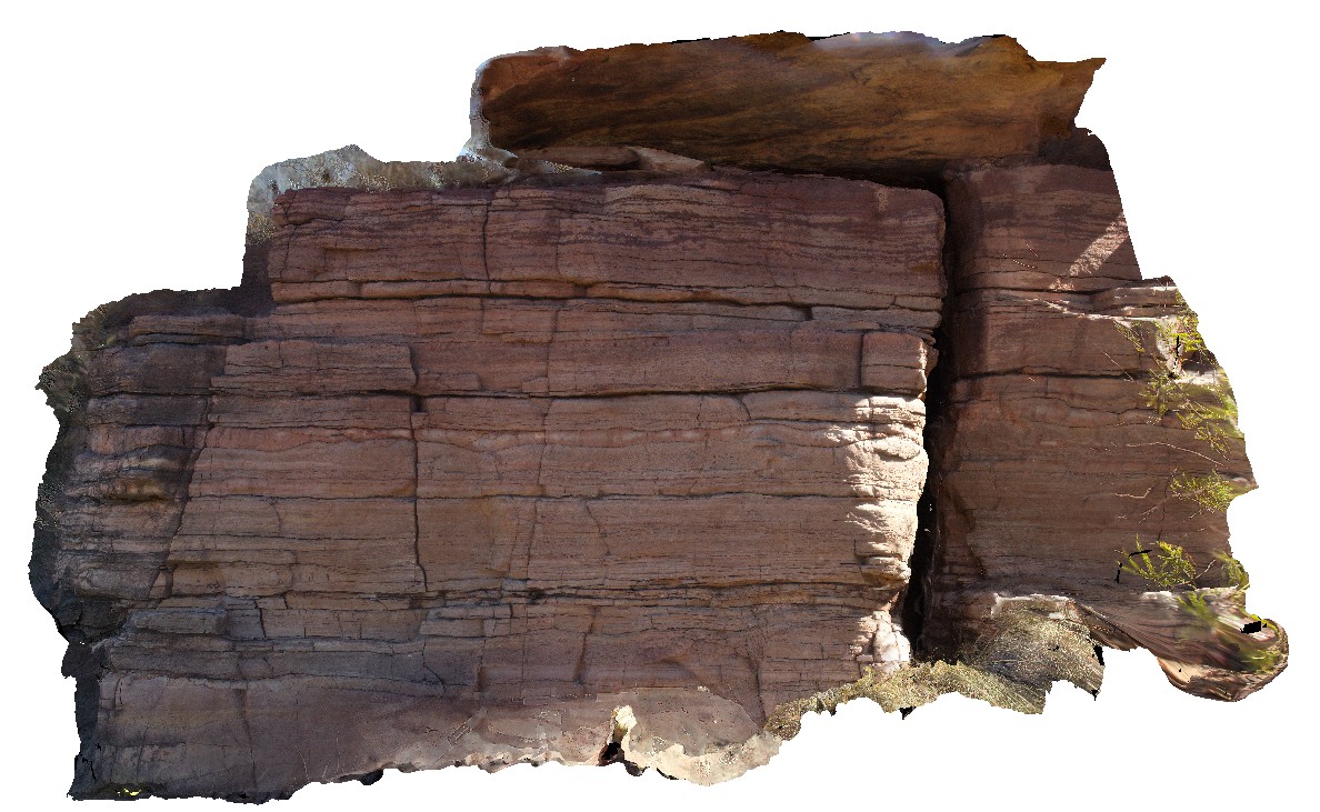
Judbarra18
Site:
Judbarra18
Downloads:
Map
3D Model:
Description:
supplejack dolostone with beds featuring mud cracks and beds with pinolitic siderite. Wickham River access track. Judbarra / Gregory National Park. N.T.
| Capture Date: | June 18, 2016, noon |
| Latitude: | -16.78477000000 degrees |
| Longitude: | 130.64874000000 degrees |
| Elevation: | NA |
| Visualisation Type: | 3D |
| Location Accuracy: | 0 metres |
Keywords:
- mud cracks
- pinolithic siderite
- sedimentology
| dolostone | |
|---|---|
| Form Type: | bedded |
| Description: | dolostone with mud cracks and pinolithic siderite. |
| Min Geological Age: | Mesoproterozoic |
| Max Geological Age: | Mesoproterozoic |
| Min Numerical Age: | 1000.000 |
| Max Numerical Age: | 1600.000 |
| Strat No: | 33808 |
| Supergroup: | |
| Group: | Bullita Group |
| Subgroup: | |
| Formation: | |
| Member: | Supplejack Dolostone Member |
| Province: | Birrindudu Basin |