Judbarra4
Site:
Judbarra4
Downloads:
Map
3D Model:
Description:
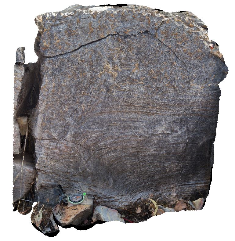
stromatolite overlain by stromatolitic conglomerate. Judbarra / Gregory National Park access road. N.T.
| Capture Date: | June 18, 2016, noon |
| Latitude: | -16.03527000000 degrees |
| Longitude: | 130.45903000000 degrees |
| Elevation: | NA |
| Visualisation Type: | 3D |
| Location Accuracy: | 0 metres |
Keywords:
- stromatolite
- stromatolitic conglomerate
- sedimentology
- fossil
- palaeontology
| limestone | |
|---|---|
| Form Type: | bedded |
| Description: | stromatolitic limestone, with stromatolitic conglomerate layers |
| Min Geological Age: | Calymmian |
| Max Geological Age: | Calymmian |
| Min Numerical Age: | 1400.000 |
| Max Numerical Age: | 1600.000 |
| Strat No: | 16978 |
| Supergroup: | |
| Group: | Bullita Group |
| Subgroup: | |
| Formation: | Skull Creek Formation |
| Member: | |
| Province: | Birrindudu Basin |