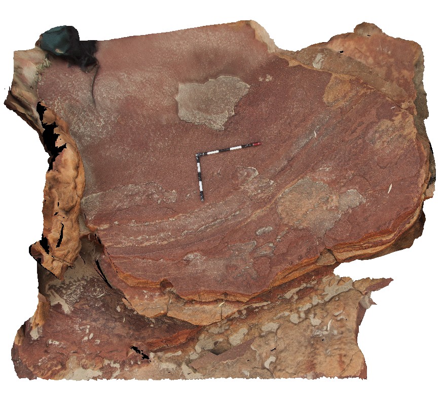
Kalbarri15
Site:
Kalbarri15
Downloads:
Map
3D Model:
Description:
Eurypterid tracks on large slab of sandstone. Upstream from 'Z bend', Kalbarri National Park. W.A.
| Capture Date: | May 20, 2016, noon |
| Latitude: | -27.65507000000 degrees |
| Longitude: | 114.45641000000 degrees |
| Elevation: | NA |
| Visualisation Type: | 3D |
| Location Accuracy: | 0 metres |
Keywords:
- Eurypterid tracks
- sandstone
- tracks
- fossil
- palaeontology
| sandstone | |
|---|---|
| Form Type: | bedded |
| Description: | Fine- to medium-grained sandstones with fossil tracks |
| Min Geological Age: | Early Silurian |
| Max Geological Age: | Late Cambrian |
| Min Numerical Age: | 0.000 |
| Max Numerical Age: | 0.000 |
| Strat No: | 18674 |
| Supergroup: | |
| Group: | |
| Subgroup: | |
| Formation: | Tumblagooda Sandstone |
| Member: | |
| Province: | Abrolhos Sub-basin, Gascoyne Sub-basin, Perth Basin, Southern Carnarvon Basin |