KalbarriUAV6
Site:
KalbarriUAV6
Downloads:
Map
3D Model:
Description:
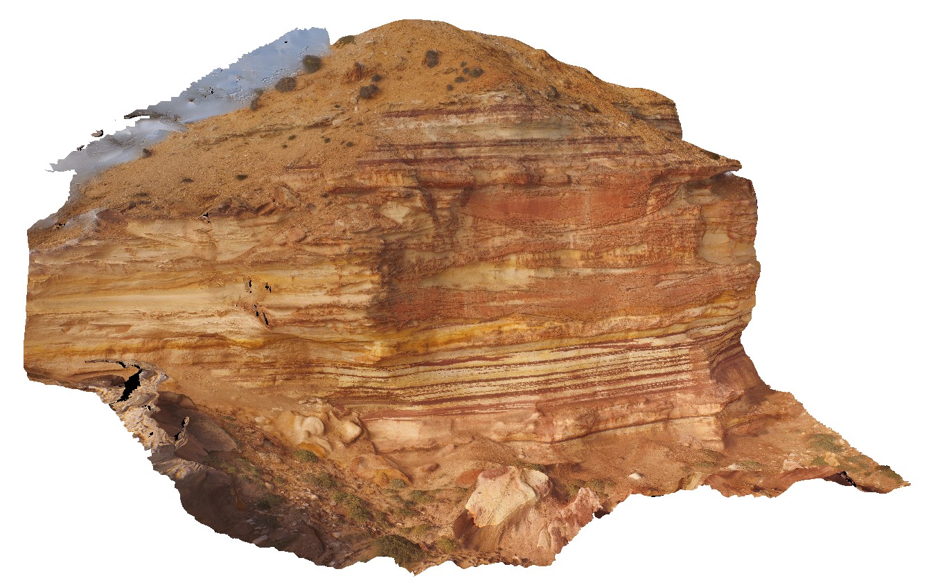
main cliff at Red Bluff, showing flat lying, thinly bedded or cross bedded sandstone of the Tumblagooda Sandstone. Kalbarri, W.A.
| Capture Date: | Undated |
| Latitude: | -27.74557200000 degrees |
| Longitude: | 114.13969200000 degrees |
| Elevation: | NA |
| Visualisation Type: | UAV |
| Location Accuracy: | 0 metres |
Keywords:
- Tumblagooda Sandstone
- cross beds
- sedimentology
| sandstone | |
|---|---|
| Form Type: | bedded |
| Description: | Fine- to medium-grained sandstones; minor conglomerate; red, commonly bioturbated siltstone towards the top of the unit. |
| Min Geological Age: | Early Silurian |
| Max Geological Age: | Late Cambrian |
| Min Numerical Age: | 433.000 |
| Max Numerical Age: | 495.000 |
| Strat No: | 18674 |
| Supergroup: | |
| Group: | |
| Subgroup: | |
| Formation: | Tumblagooda Sandstone |
| Member: | |
| Province: | Abrolhos Sub-basin, Gascoyne Sub-basin, Perth Basin, Southern Carnarvon Basin |