Karijini17
Site:
Karijini17
Downloads:
Map
3D Model:
Description:
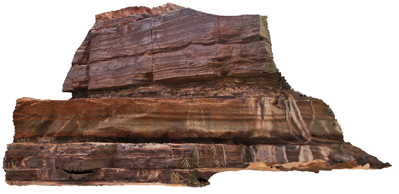
section through part of the Brockman Iron Formation, showing (from the bottom up); BIF, silicified carbonate; pyritic shale and BIF. Dales Gorge, Karijini National Park. W.A.
| Capture Date: | May 29, 2016, noon |
| Latitude: | -22.47609000000 degrees |
| Longitude: | 118.56262000000 degrees |
| Elevation: | NA |
| Visualisation Type: | 3D |
| Location Accuracy: | 0 metres |
Keywords:
- cross-section
- Banded iron formation
- silicified carbonate
- pyritic shale
- sedimentology
| BIF | |
|---|---|
| Form Type: | bedded |
| Description: | Banded iron-formation, silicified carbonate and pyritic shale. |
| Min Geological Age: | Siderian |
| Max Geological Age: | Neoarchean |
| Min Numerical Age: | 2451.000 |
| Max Numerical Age: | 2495.000 |
| Strat No: | 2602 |
| Supergroup: | Mount Bruce Supergroup |
| Group: | |
| Subgroup: | |
| Formation: | Brockman Iron Formation |
| Member: | |
| Province: | Hamersley Basin |