Kath2
Site:
Kath2
Downloads:
Map
3D Model:
Description:
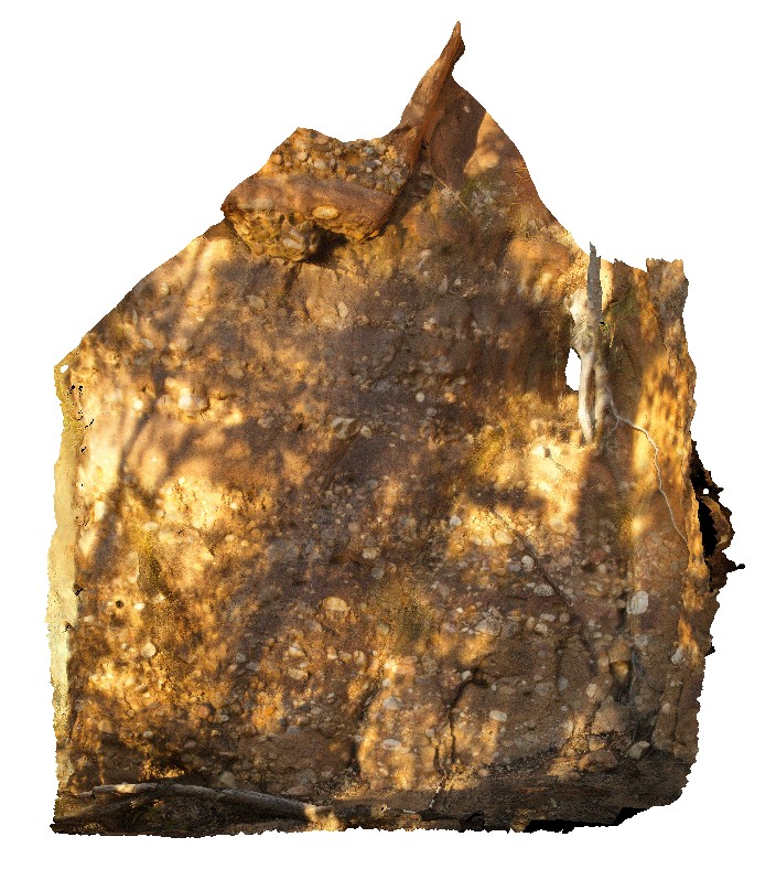
outcrop of conglomerate / cobble bands in sandstone at the edge of the Katherine River. Katherine Gorge, N.T.
| Capture Date: | July 20, 2016, 5:56 p.m. |
| Latitude: | -14.31142700000 degrees |
| Longitude: | 132.42550800000 degrees |
| Elevation: | 135.243 metres |
| Visualisation Type: | 3D |
| Location Accuracy: | 0 metres |
Keywords:
- conglomerate
- banding
- sandstone
- sedimentology
| sandstone | |
|---|---|
| Form Type: | bedded |
| Description: | sandy? Matrix supported conglomerate of rounded cobbles, with bedding and cobble rich beds. |
| Min Geological Age: | Statherian |
| Max Geological Age: | Orosirian |
| Min Numerical Age: | 1740.000 |
| Max Numerical Age: | 1822.000 |
| Strat No: | 33373 |
| Supergroup: | |
| Group: | Katherine River Group |
| Subgroup: | Kombolgie Subgroup |
| Formation: | |
| Member: | |
| Province: |