Kings5
Site:
Kings5
Downloads:
Map
3D Model:
Description:
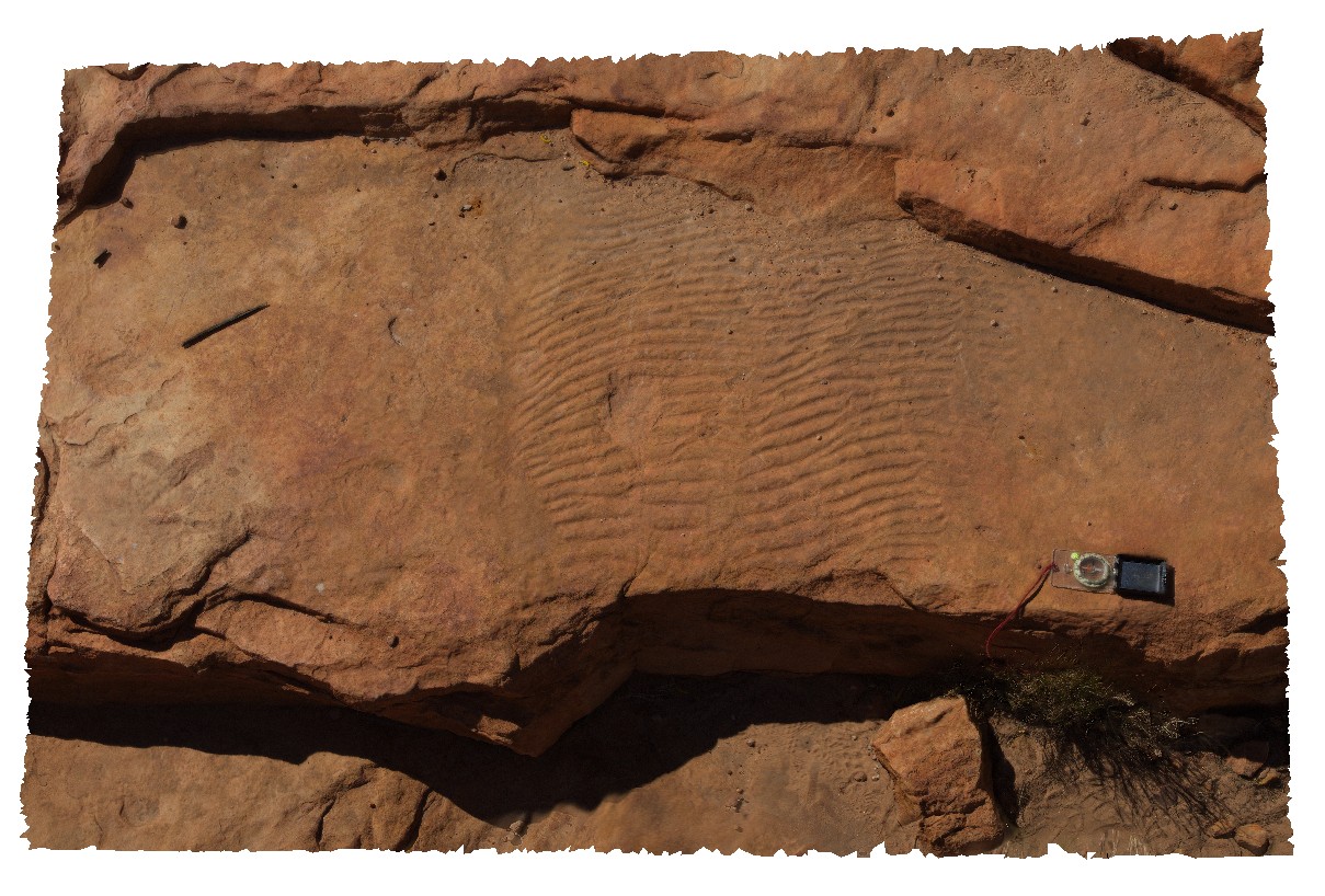
ripple marks exposed on bedding surface of Mereenie Sandstone. Kings Canyon, Watarrka National Park, N.T.
| Capture Date: | July 31, 2016, 11:35 a.m. |
| Latitude: | -24.24900700000 degrees |
| Longitude: | 131.57960600000 degrees |
| Elevation: | 746.684 metres |
| Visualisation Type: | 3D |
| Location Accuracy: | 0 metres |
Keywords:
- Mereenie Sandstone
- ripple marks
- bedding surface
- sedimentology
| sandstone | |
|---|---|
| Form Type: | bedded |
| Description: | Porous, white to pale-brown, fine grained, well sorted quartz sandstone with ripple marks on bedding surfaces |
| Min Geological Age: | Middle Devonian |
| Max Geological Age: | Late Ordovician |
| Min Numerical Age: | 398.000 |
| Max Numerical Age: | 461.000 |
| Strat No: | 11667 |
| Supergroup: | |
| Group: | |
| Subgroup: | |
| Formation: | Mereenie Sandstone |
| Member: | |
| Province: | Amadeus Basin |