KingsFSP3
Site:
KingsFSP3
Downloads:
Map
Description:
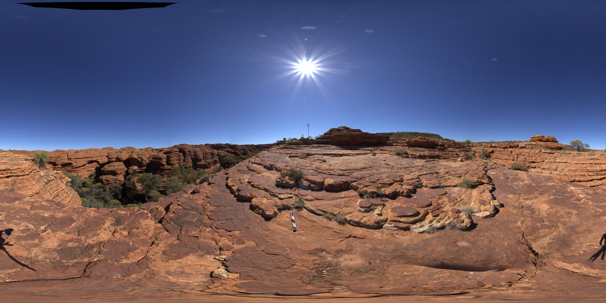
panorama view, showing weathering and mud cracks? In the foreground and bedded strata of the Mereenie Sandstone in the background. Kings Canyon, Watarrka National Park, N.T.
| Capture Date: | July 31, 2016, 12:28 p.m. |
| Latitude: | -24.24925300000 degrees |
| Longitude: | 131.58338800000 degrees |
| Elevation: | 747.126 metres |
| Visualisation Type: | FSP |
| Location Accuracy: | 5 metres |
Keywords:
- mud cracks
- weathering
- joint
- sedimentology
- Mereenie Sandstone
| sandstone | |
|---|---|
| Form Type: | bedded |
| Description: | Porous, white to pale-brown, fine grained, well sorted quartz sandstone with mud cracks |
| Min Geological Age: | Middle Devonian |
| Max Geological Age: | Late Ordovician |
| Min Numerical Age: | 398.000 |
| Max Numerical Age: | 461.000 |
| Strat No: | 11667 |
| Supergroup: | |
| Group: | |
| Subgroup: | |
| Formation: | Mereenie Sandstone |
| Member: | |
| Province: | Amadeus Basin |