KingstonUAV1
Site:
KingstonUAV1
Downloads:
Map
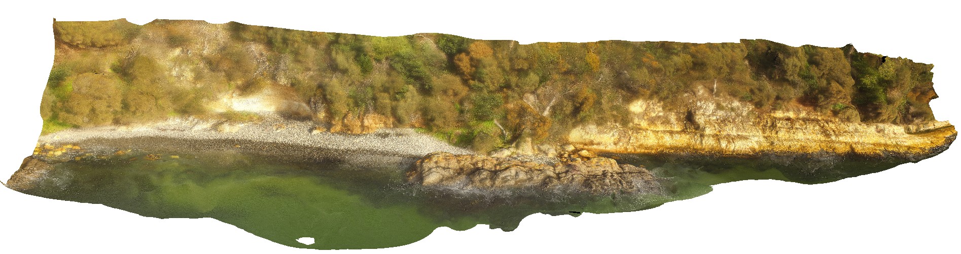
3D Model:
Description:
aerial view of Permian sandstone contact with Jurassic dolerite. Shore exposure south of Kingston Beach, Tas.
| Capture Date: | July 15, 2016, noon |
| Latitude: | -42.98581000000 degrees |
| Longitude: | 147.32770000000 degrees |
| Elevation: | NA |
| Visualisation Type: | UAV |
| Location Accuracy: | 20 metres |
Keywords:
- Permian sandstone
- Jurassic dolerite
- intrusive contact
| sandstone | |
|---|---|
| Form Type: | bedded |
| Description: | thickly bedded glacigene and shallow-water glaciomarine fine-grained sandstone and siltstone beds with dropstones. |
| Min Geological Age: | Permian |
| Max Geological Age: | Late Carboniferous |
| Min Numerical Age: | 252.170 |
| Max Numerical Age: | 323.200 |
| Strat No: | 14900 |
| Supergroup: | Parmeener Supergroup |
| Group: | |
| Subgroup: | |
| Formation: | Parmeener Supergroup, Lower |
| Member: | |
| Province: | Melbourne-Mathinna Zone |
| dolerite | |
|---|---|
| Form Type: | sill |
| Description: | Pipes and dykes of tholeiitic dolerite intrusions, becoming sheet-like at various levels in the Parmeener Supergroup from near the base. Intrudes Bundella Formation, caps the Knocklofty Formation. Caused contact metamorphic effects |
| Min Geological Age: | Jurassic |
| Max Geological Age: | Jurassic |
| Min Numerical Age: | 145.000 |
| Max Numerical Age: | 201.300 |
| Strat No: | 17883 |
| Supergroup: | |
| Group: | |
| Subgroup: | |
| Formation: | Tasmanian Dolerite |
| Member: | |
| Province: | Tasmania Basin |