KirtonUAV1
Site:
KirtonUAV1
Downloads:
Map
3D Model:
Description:
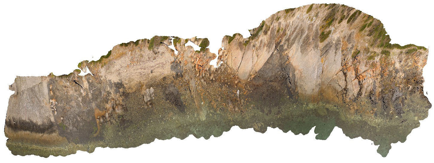
aerial view of exposed shore platform, showing Kirton Point and the Colbert Granite/ granite gneiss, with mafic intrusives? Port Lincoln. S.A.
| Capture Date: | Oct. 20, 2015, 3:07 p.m. |
| Latitude: | -34.72473000000 degrees |
| Longitude: | 135.88480000000 degrees |
| Elevation: | NA |
| Visualisation Type: | UAV |
| Location Accuracy: | 20 metres |
Keywords:
- granite gneiss
| granite | |
|---|---|
| Form Type: | |
| Description: | Granite and granite gneiss intruding megacrystic granite. |
| Min Geological Age: | Paleoproterozoic |
| Max Geological Age: | Paleoproterozoic |
| Min Numerical Age: | 1852.000 |
| Max Numerical Age: | 1852.000 |
| Strat No: | 33836 |
| Supergroup: | Donington Suite |
| Group: | |
| Subgroup: | |
| Formation: | Colbert Granite |
| Member: | |
| Province: |