LakeArgyle2
Site:
LakeArgyle2
Downloads:
Map
3D Model:
Description:
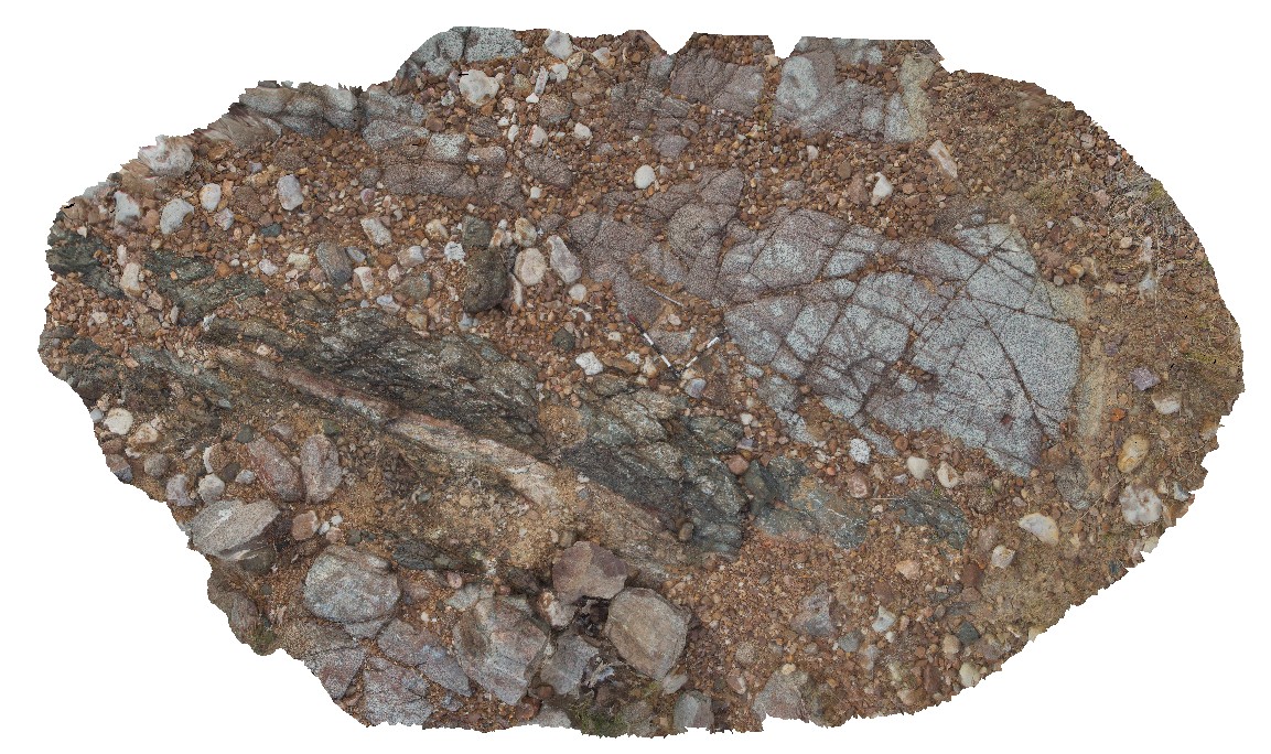
granite intruded by brecciated mafic dyke with faulted contacts. River crossing of Lake Argyle Road, W.A.
| Capture Date: | June 16, 2016, noon |
| Latitude: | -16.03106000000 degrees |
| Longitude: | 128.78183000000 degrees |
| Elevation: | NA |
| Visualisation Type: | 3D |
| Location Accuracy: | 5 metres |
Keywords:
- mafic dyke
- igneous intrusion
- granite
- fault
| mafic | |
|---|---|
| Form Type: | dyke |
| Description: | mafic / amphibolite? Dyke. Age unknown. |
| Min Geological Age: | |
| Max Geological Age: | |
| Min Numerical Age: | 0.000 |
| Max Numerical Age: | 0.000 |
| Strat No: | 0 |
| Supergroup: | |
| Group: | |
| Subgroup: | |
| Formation: | |
| Member: | |
| Province: |
| granite | |
|---|---|
| Form Type: | pluton |
| Description: | medium- to coarse-grained, porphyritic biotite granite |
| Min Geological Age: | Orosirian |
| Max Geological Age: | Orosirian |
| Min Numerical Age: | 1850.000 |
| Max Numerical Age: | 1865.000 |
| Strat No: | 31788 |
| Supergroup: | Paperbark Supersuite |
| Group: | |
| Subgroup: | |
| Formation: | |
| Member: | |
| Province: | Halls Creek Orogen, Hooper Province, Lamboo Province |