LakeArgyle6
Site:
LakeArgyle6
Downloads:
Map
3D Model:
Description:
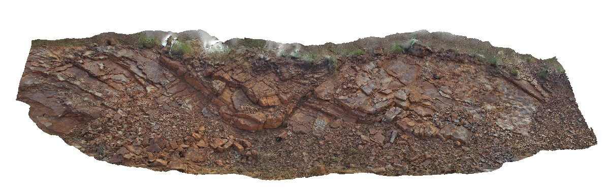
gently dipping, wavy, laminated red and white banded siltstone cut by small fault offset. Lake Argyle Road, W.A.
| Capture Date: | June 16, 2016, noon |
| Latitude: | -16.05236000000 degrees |
| Longitude: | 128.76532000000 degrees |
| Elevation: | NA |
| Visualisation Type: | 3D |
| Location Accuracy: | 0 metres |
Keywords:
- siltstone
- fault
| siltstone | |
|---|---|
| Form Type: | bedded |
| Description: | Sandstone, ferruginous sandstone, siltstone and mudstone. |
| Min Geological Age: | Ectasian |
| Max Geological Age: | Ectasian |
| Min Numerical Age: | 1200.000 |
| Max Numerical Age: | 1400.000 |
| Strat No: | 3663 |
| Supergroup: | |
| Group: | Carr Boyd Group |
| Subgroup: | |
| Formation: | |
| Member: | |
| Province: | Halls Creek Orogen |