Liptrap11
Site:
Liptrap11
Downloads:
Map
3D Model:
Description:
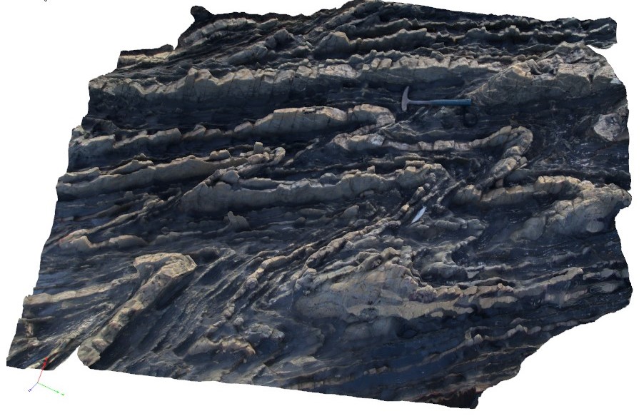
gently to moderately asymmetric folding, showing 'z' sense. Cape Liptrap, Vic.
| Capture Date: | March 13, 2015, 9:17 a.m. |
| Latitude: | -38.90396425000 degrees |
| Longitude: | 145.91697334000 degrees |
| Elevation: | 0.000 metres |
| Visualisation Type: | 3D |
| Location Accuracy: | 20 metres |
Keywords:
- z asymmetric folds
- structure
| turbidite | |
|---|---|
| Form Type: | bedded |
| Description: | finely bedded sandstone and siltstone turbidites. |
| Min Geological Age: | Early Devonian |
| Max Geological Age: | Early Devonian |
| Min Numerical Age: | 410.800 |
| Max Numerical Age: | 419.200 |
| Strat No: | 26691 |
| Supergroup: | Murrindindi Supergroup |
| Group: | Walhalla Group |
| Subgroup: | |
| Formation: | Liptrap Formation |
| Member: | |
| Province: | Lachlan Orogen |