Liptrap4
Site:
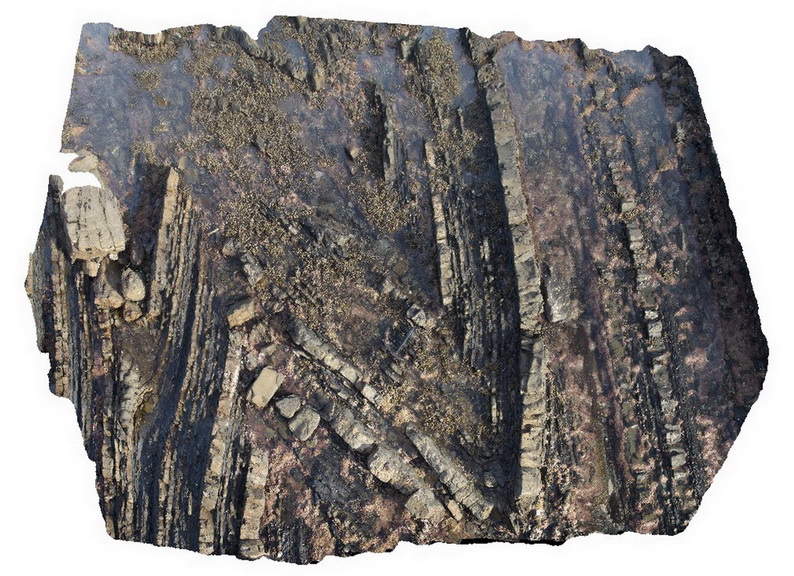
Liptrap4
Downloads:
Map
3D Model:
Description:
open to closed folding of sandstone and siltstone layers in distal turbidites. Cape Liptrap, Vic.
| Capture Date: | March 13, 2015, 9:21 a.m. |
| Latitude: | -38.90403052000 degrees |
| Longitude: | 145.91719914000 degrees |
| Elevation: | NA |
| Visualisation Type: | 3D |
| Location Accuracy: | 0 metres |
Keywords:
- turbidite
- sedimentology
- fold
| turbidite | |
|---|---|
| Form Type: | bedded |
| Description: | finely bedded sandstone and siltstone turbidite |
| Min Geological Age: | Early Devonian |
| Max Geological Age: | Early Devonian |
| Min Numerical Age: | 410.800 |
| Max Numerical Age: | 419.200 |
| Strat No: | 26691 |
| Supergroup: | Murrindindi Supergroup |
| Group: | Walhalla Group |
| Subgroup: | |
| Formation: | Liptrap Formation |
| Member: | |
| Province: | Lachlan Orogen |