LordHowe7
Site:
LordHowe7
Downloads:
Map
3D Model:
Description:
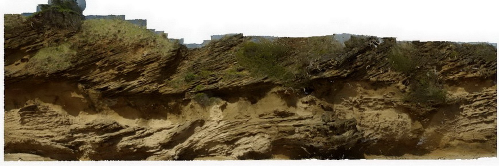
cross bedding in calcareous sands, showing high-angle beds truncated by flat overlying layers. Lord Howe Island.
| Capture Date: | March 16, 2015, 2:52 p.m. |
| Latitude: | -31.54798706000 degrees |
| Longitude: | 159.07471865000 degrees |
| Elevation: | NA |
| Visualisation Type: | 3D |
| Location Accuracy: | 0 metres |
Keywords:
- sedimentology
- cross bedding
| sand | |
|---|---|
| Form Type: | bedded |
| Description: | bedded, calcareous sands showing cross bedding |
| Min Geological Age: | Cenozoic |
| Max Geological Age: | Cenozoic |
| Min Numerical Age: | 0.012 |
| Max Numerical Age: | 66.000 |
| Strat No: | 0 |
| Supergroup: | |
| Group: | |
| Subgroup: | |
| Formation: | |
| Member: | |
| Province: |