MacquariePlains2
Site:
MacquariePlains2
Downloads:
Map
3D Model:
Description:
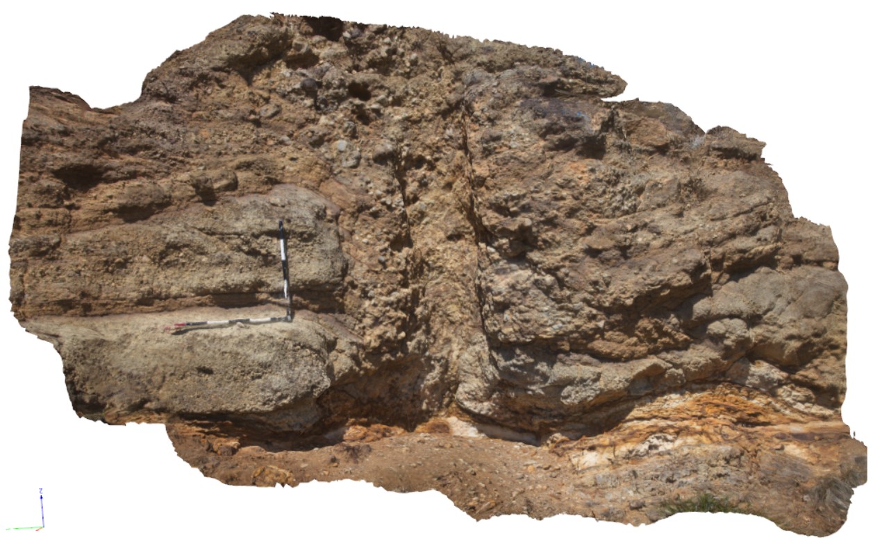
detail from location MacquariePlanes1. detail of pyroclastic deposits and tree mould. Macquarie Plains, Tas.
| Capture Date: | Feb. 23, 2016, 9:23 a.m. |
| Latitude: | -42.70333000000 degrees |
| Longitude: | 146.91592000000 degrees |
| Elevation: | NA |
| Visualisation Type: | 3D |
| Location Accuracy: | 0 metres |
Keywords:
- pyroclastic
- basalt
| basalt | |
|---|---|
| Form Type: | pyroclastite |
| Description: | Tertiary Basalts. Tholeiitic to alkalic and related volcanic rocks. Stratigraphic relationships unknown. |
| Min Geological Age: | Neogene |
| Max Geological Age: | Paleogene |
| Min Numerical Age: | 2.580 |
| Max Numerical Age: | 66.000 |
| Strat No: | 0 |
| Supergroup: | |
| Group: | |
| Subgroup: | |
| Formation: | |
| Member: | |
| Province: |