MansfieldRd5
Site:
MansfieldRd5
Downloads:
Map
3D Model:
Description:
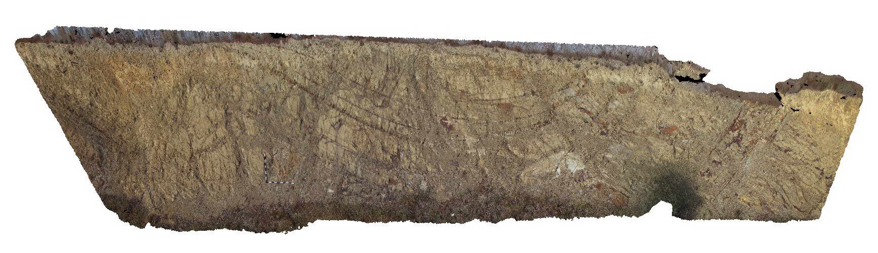
open fold in bedded sandstone of the Devonian Norton Gully Sandstone. Mansfield Road, Vic.
| Capture Date: | June 17, 2015, 10:29 a.m. |
| Latitude: | -37.02049000000 degrees |
| Longitude: | 145.89662000000 degrees |
| Elevation: | 332.000 metres |
| Visualisation Type: | 3D |
| Location Accuracy: | 5 metres |
Keywords:
- fold
- structure
| sandstone | |
|---|---|
| Form Type: | bedded |
| Description: | thickly bedded fine grained sandstone |
| Min Geological Age: | Devonian |
| Max Geological Age: | Devonian |
| Min Numerical Age: | 393.000 |
| Max Numerical Age: | 407.000 |
| Strat No: | 14304 |
| Supergroup: | Murrindindi Supergroup |
| Group: | Walhalla Group |
| Subgroup: | |
| Formation: | Norton Gully Sandstone |
| Member: | |
| Province: | Lachlan Orogen |