MistakeCreek2
Site:
MistakeCreek2
Downloads:
Map
3D Model:
Description:
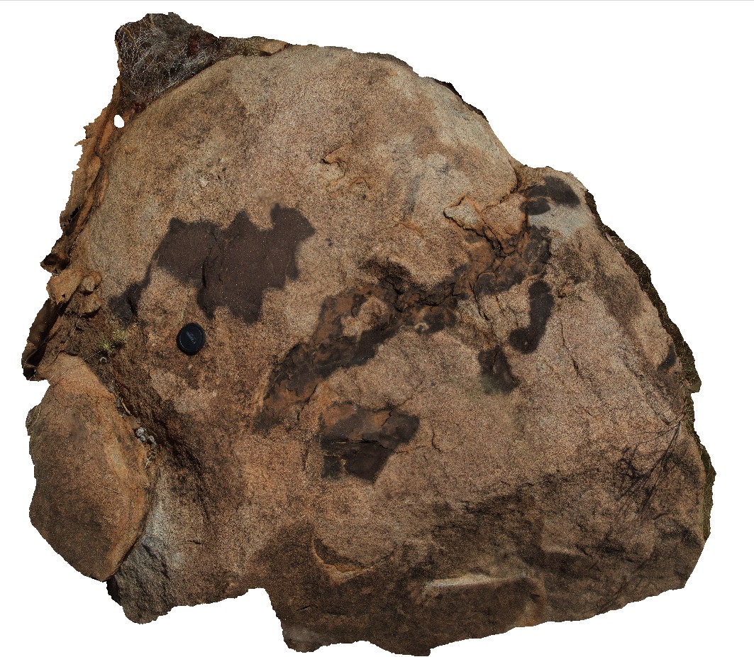
mafic, amoeboid and pegmatitic pods in granite. Mistake Creek, Great Northern Highway, north of Warmun Roadhouse. W.A.
| Capture Date: | June 11, 2016, noon |
| Latitude: | -16.94450000000 degrees |
| Longitude: | 128.24121000000 degrees |
| Elevation: | NA |
| Visualisation Type: | 3D |
| Location Accuracy: | 0 metres |
Keywords:
- granite
- mafic amoeboid pod
- pegmatite pod
| granite | |
|---|---|
| Form Type: | pluton |
| Description: | medium-grained quartz-feldspar granite with pegmatite pod (biotite-k-feldspar-quartz) and mafic (K-feldspar phyric) intrusions. |
| Min Geological Age: | Orosirian |
| Max Geological Age: | Orosirian |
| Min Numerical Age: | 1800.000 |
| Max Numerical Age: | 1835.000 |
| Strat No: | 31785 |
| Supergroup: | Sally Downs Supersuite |
| Group: | |
| Subgroup: | |
| Formation: | |
| Member: | |
| Province: | Halls Creek Orogen, Lamboo Province |