Mitchell1
Site:
Mitchell1
Downloads:
Map
3D Model:
Description:
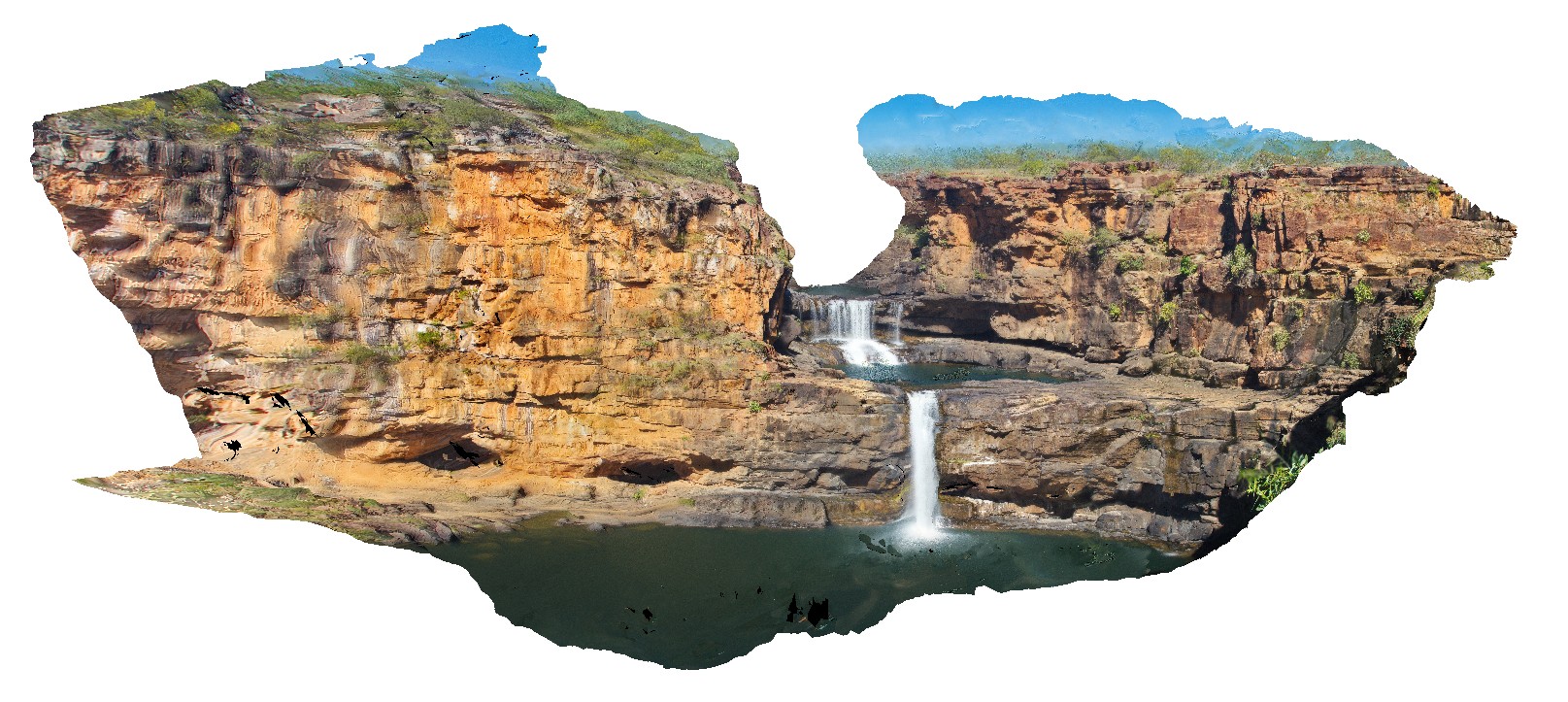
overview of Mitchell Falls, Mitchell River, Kimberley. W.A.
| Capture Date: | June 8, 2016, noon |
| Latitude: | -14.82099000000 degrees |
| Longitude: | 125.69496000000 degrees |
| Elevation: | NA |
| Visualisation Type: | 3D |
| Location Accuracy: | 0 metres |
Keywords:
- water fall
- Mitchell Falls
- King Leopold Sandstone
| sandstone | |
|---|---|
| Form Type: | bedded |
| Description: | White to pale brown, medium- to coarse-grained quartz sandstone and pebbly quartz sandstone; minor siltstone and granule to pebble conglomerate. |
| Min Geological Age: | Statherian |
| Max Geological Age: | Orosirian |
| Min Numerical Age: | 1790.000 |
| Max Numerical Age: | 1834.000 |
| Strat No: | 9602 |
| Supergroup: | |
| Group: | Kimberley Group |
| Subgroup: | |
| Formation: | King Leopold Sandstone |
| Member: | |
| Province: | Kimberley Basin |