MtBlair2
Site:
MtBlair2
Downloads:
Map
3D Model:
Description:
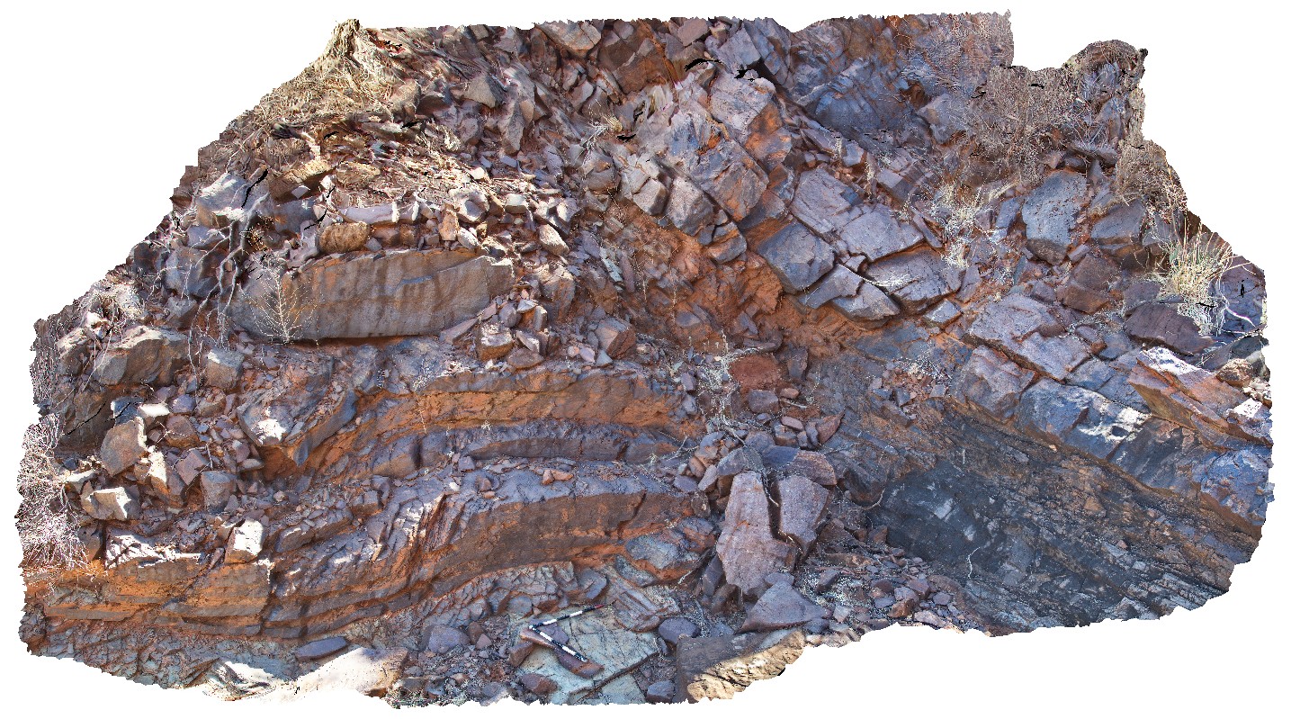
detail of the angular Ashburton-Capricorn unconformity, with open folds in the Ashburton rocks. Near Mount Blair on the Ashburton - Meekatharra Road, W.A.
| Capture Date: | May 28, 2016, noon |
| Latitude: | -23.44297000000 degrees |
| Longitude: | 117.13130000000 degrees |
| Elevation: | NA |
| Visualisation Type: | 3D |
| Location Accuracy: | 0 metres |
Keywords:
- angular unconformity
- folds
| siltstone | |
|---|---|
| Form Type: | bedded |
| Description: | siltstone and very fine-grained sandstone. Lower greenschist facies. |
| Min Geological Age: | Statherian |
| Max Geological Age: | Orosirian |
| Min Numerical Age: | 1786.000 |
| Max Numerical Age: | 2008.000 |
| Strat No: | 698 |
| Supergroup: | |
| Group: | |
| Subgroup: | |
| Formation: | Ashburton Formation |
| Member: | |
| Province: | Ashburton Basin |
| siltstone | |
|---|---|
| Form Type: | bedded |
| Description: | Ferruginous and quartzose sandstone, ferruginous siltstone and mudstone, conglomerate, dolostone and felsic volcanic rock. |
| Min Geological Age: | Orosirian |
| Max Geological Age: | Orosirian |
| Min Numerical Age: | 1800.000 |
| Max Numerical Age: | 1804.000 |
| Strat No: | 3558 |
| Supergroup: | |
| Group: | Capricorn Group |
| Subgroup: | |
| Formation: | |
| Member: | |
| Province: |