MtBruce1
Site:
MtBruce1
Downloads:
Map
3D Model:
Description:
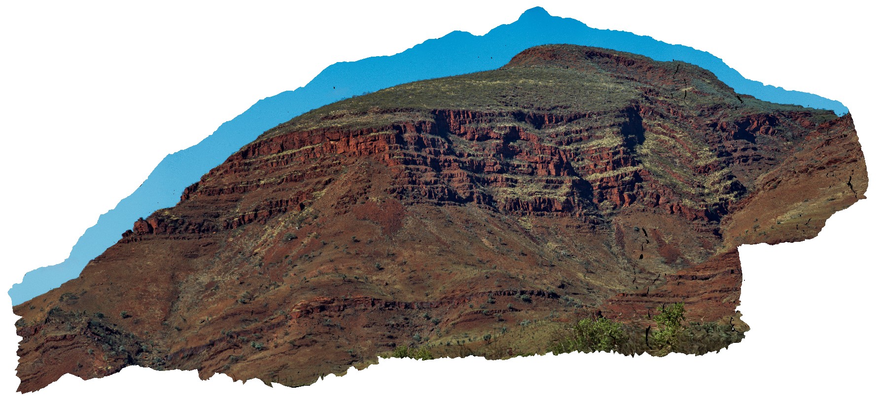
view of the stratigraphy of Mount Bruce. Exposed core of synform with the Brockman Iron Formation and Mount McRae Shale and Mount Sylvia Formations. Openly folded, gently dipping stratigraphy. Mount Bruce, Pilbara, W.A.
| Capture Date: | May 29, 2016, noon |
| Latitude: | -22.57421700000 degrees |
| Longitude: | 118.13826800000 degrees |
| Elevation: | NA |
| Visualisation Type: | 3D |
| Location Accuracy: | 0 metres |
Keywords:
- Mount Bruce
- Pilbara
- fold
- open fold
| BIF | |
|---|---|
| Form Type: | bedded |
| Description: | multiply layered, banded iron-formation, chert, mudstone and siltstone. |
| Min Geological Age: | Siderian |
| Max Geological Age: | Neoarchean |
| Min Numerical Age: | 2451.000 |
| Max Numerical Age: | 2495.000 |
| Strat No: | 2602 |
| Supergroup: | Mount Bruce Supergroup Mount Bruce Supergroup |
| Group: | |
| Subgroup: | |
| Formation: | Brockman Iron Formation |
| Member: | |
| Province: | Hamersley Basin |
| shale | |
|---|---|
| Form Type: | bedded |
| Description: | Mudstone, siltstone, chert, iron-formation, and dolomite. Thin bands of shard-bearing volcanic ash in upper parts. |
| Min Geological Age: | Paleoproterozoic |
| Max Geological Age: | Neoarchean |
| Min Numerical Age: | 2494.000 |
| Max Numerical Age: | 2505.000 |
| Strat No: | 12926 |
| Supergroup: | Mount Bruce Supergroup |
| Group: | |
| Subgroup: | |
| Formation: | Mount McRae Shale |
| Member: | |
| Province: | Hamersley Basin |