MtGambier3
Site:
MtGambier3
Downloads:
Map
3D Model:
Description:
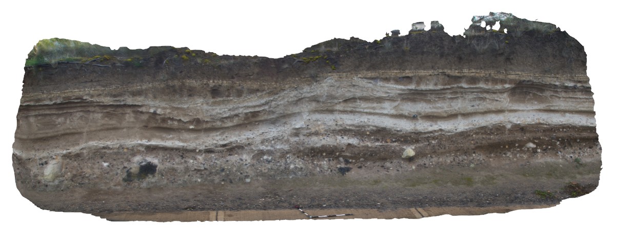
view of tuff deposit layering and overlying soil profile. Mount Gambier, S.A.
| Capture Date: | June 5, 2016, 10:47 a.m. |
| Latitude: | -37.85133000000 degrees |
| Longitude: | 140.77747000000 degrees |
| Elevation: | NA |
| Visualisation Type: | 3D |
| Location Accuracy: | 0 metres |
Keywords:
- tuff
- soil horizon
| tuff | |
|---|---|
| Form Type: | bedded |
| Description: | volcanic tuff deposits |
| Min Geological Age: | Quaternary |
| Max Geological Age: | Quaternary |
| Min Numerical Age: | 0.012 |
| Max Numerical Age: | 2.580 |
| Strat No: | 28796 |
| Supergroup: | |
| Group: | Mount Gambier Volcanic Complex |
| Subgroup: | |
| Formation: | |
| Member: | |
| Province: |
| soil | |
|---|---|
| Form Type: | bedded |
| Description: | unconsolidated soil and humitic layers. Age unknown |
| Min Geological Age: | |
| Max Geological Age: | |
| Min Numerical Age: | 0.000 |
| Max Numerical Age: | 0.000 |
| Strat No: | 0 |
| Supergroup: | |
| Group: | |
| Subgroup: | |
| Formation: | |
| Member: | |
| Province: |