MtGambierFSP1
Site:
MtGambierFSP1
Downloads:
Map
Description:
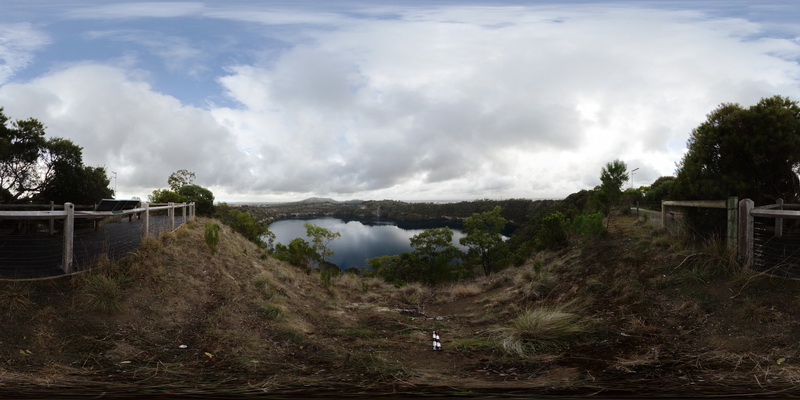
view from Blue Lake lookout, showing view of the volcanic crater forming Blue Lake and surrounding country side. Mount Gambier, S.A.
| Capture Date: | June 5, 2016, 10:48 a.m. |
| Latitude: | -37.85010000000 degrees |
| Longitude: | 140.78181000000 degrees |
| Elevation: | NA |
| Visualisation Type: | FSP |
| Location Accuracy: | 0 metres |
Keywords:
- Volcanic Centre
- crater
| igneous | |
|---|---|
| Form Type: | volcanic |
| Description: | volcanic complex of lava flows and deposits of volcanic ash and tuff. |
| Min Geological Age: | Quaternary |
| Max Geological Age: | Quaternary |
| Min Numerical Age: | 0.012 |
| Max Numerical Age: | 2.580 |
| Strat No: | 28796 |
| Supergroup: | |
| Group: | Mount Gambier Volcanic Complex |
| Subgroup: | |
| Formation: | |
| Member: | |
| Province: |