Munjina2
Site:
Munjina2
Downloads:
Map
3D Model:
Description:
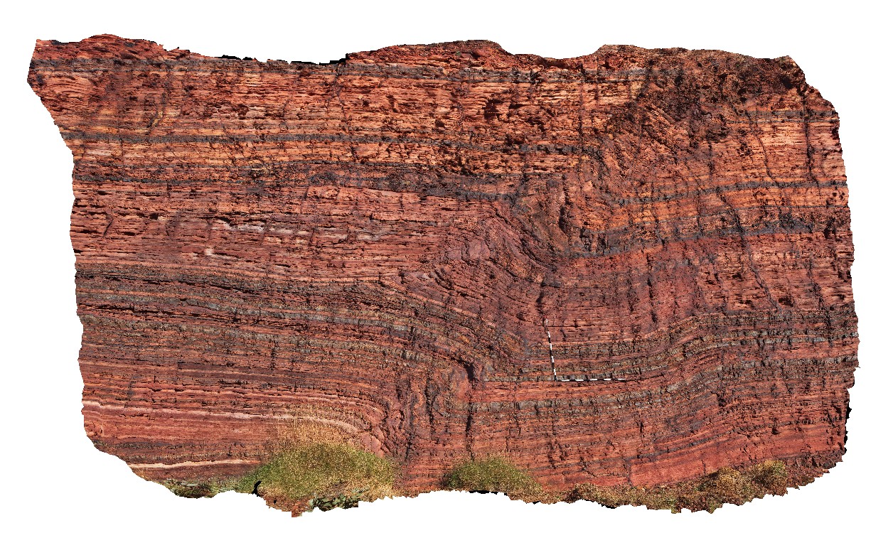
open fold in finely layered banded iron formation of the Wittenoom Formation, East of Mount George, Karijini. W.A.
| Capture Date: | May 31, 2016, noon |
| Latitude: | -22.41183000000 degrees |
| Longitude: | 118.68569000000 degrees |
| Elevation: | NA |
| Visualisation Type: | 3D |
| Location Accuracy: | 5 metres |
Keywords:
- Wittenoom Formation
- banded iron formation
- fold
- structure
- sedimentology
| BIF | |
|---|---|
| Form Type: | bedded |
| Description: | finely bedded chert, BIF and siltstone and sandstones |
| Min Geological Age: | Neoarchean |
| Max Geological Age: | Neoarchean |
| Min Numerical Age: | 2506.000 |
| Max Numerical Age: | 2596.000 |
| Strat No: | 20327 |
| Supergroup: | Mount Bruce Supergroup |
| Group: | |
| Subgroup: | |
| Formation: | Wittenoom Formation |
| Member: | |
| Province: | Hamersley Basin |