NDALAFSP3
Site:
NDALAFSP3
Downloads:
Map
Description:
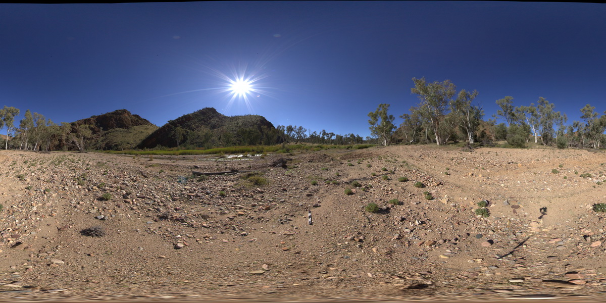
Hill to NW, showing contact between Cambrian - younger Pertaoorrta Group (left) and Neoproterozoic - Arumbera Sandstone (right) strata. N'Dala Gorge. Near Ross River, N.T.
| Capture Date: | July 27, 2016, 3:21 p.m. |
| Latitude: | -23.60026000000 degrees |
| Longitude: | 134.48699700000 degrees |
| Elevation: | 491.143 metres |
| Visualisation Type: | FSP |
| Location Accuracy: | 5 metres |
Keywords:
- sedimentology
- geological contact
- Pertaoorrta Group
| sandstone | |
|---|---|
| Form Type: | bedded |
| Description: | brown, thinly bedded fine and medium micaceous feldspathic sandstone; minor pebble conglomerate and micaceous siltstone. |
| Min Geological Age: | Early Cambrian |
| Max Geological Age: | Ediacaran |
| Min Numerical Age: | 500.000 |
| Max Numerical Age: | 590.000 |
| Strat No: | 668 |
| Supergroup: | |
| Group: | Pertaoorrta Group |
| Subgroup: | |
| Formation: | Arumbera Sandstone |
| Member: | |
| Province: | Amadeus Basin |
| sediments | |
|---|---|
| Form Type: | bedded |
| Description: | Sandstone, siltstone, shale, limestone, dolomite, some conglomerate. Marine fossils. |
| Min Geological Age: | Cambrian |
| Max Geological Age: | Neoproterozoic |
| Min Numerical Age: | 0.000 |
| Max Numerical Age: | 0.000 |
| Strat No: | 15091 |
| Supergroup: | |
| Group: | Pertaoorrta Group |
| Subgroup: | |
| Formation: | |
| Member: | |
| Province: |