NDALAUAV1
Site:
NDALAUAV1
Downloads:
Map
3D Model:
Description:
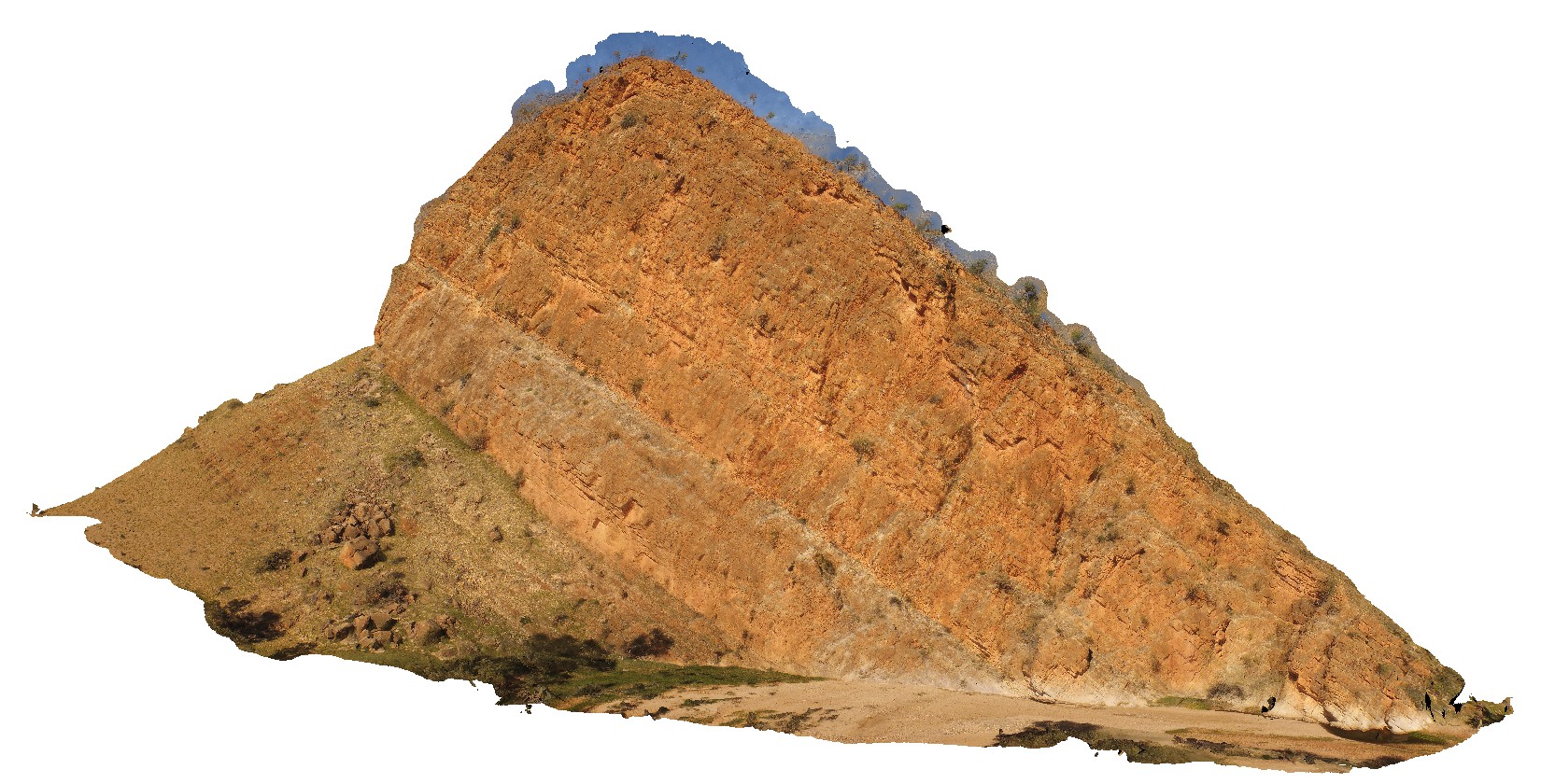
large cliff with steeply dipping strata. N'Dala Gorge. Near Ross River, N.T.
| Capture Date: | July 27, 2016, 2:27 p.m. |
| Latitude: | -23.60624600000 degrees |
| Longitude: | 134.49336300000 degrees |
| Elevation: | 491.971 metres |
| Visualisation Type: | UAV |
| Location Accuracy: | 0 metres |
Keywords:
- sediments
- dip
- structure
- fold
| sediments | |
|---|---|
| Form Type: | bedded |
| Description: | Sandstone, siltstone, shale, limestone, dolomite, some conglomerate. Marine fossils. |
| Min Geological Age: | Cambrian |
| Max Geological Age: | Neoproterozoic |
| Min Numerical Age: | 485.400 |
| Max Numerical Age: | 1000.000 |
| Strat No: | 15091 |
| Supergroup: | |
| Group: | Pertaoorrta Group |
| Subgroup: | |
| Formation: | |
| Member: | |
| Province: | Amadeus Basin |