NTas4
Site:
NTas4
Downloads:
Map
3D Model:
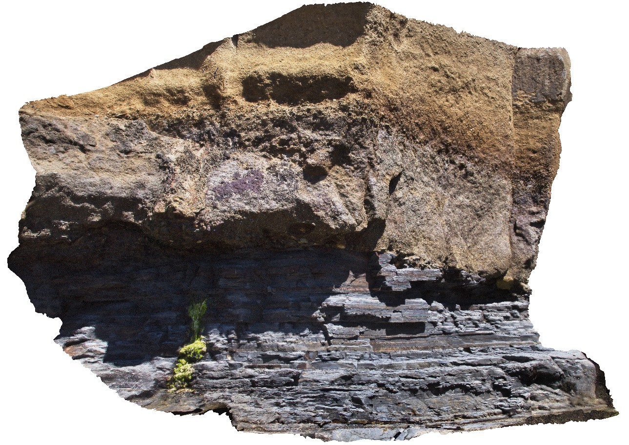
Description:
geological unconformity between the Fossil Bluff Sandstone and underlying Permian rocks. Fossil Bluff Conservation Area, Wynyard. North Tasmania.
| Capture Date: | Undated |
| Latitude: | -40.98105000000 degrees |
| Longitude: | 145.73289000000 degrees |
| Elevation: | NA |
| Visualisation Type: | 3D |
| Location Accuracy: | 5 metres |
Keywords:
- unconformity
- geological contact
| sandstone | |
|---|---|
| Form Type: | bedded |
| Description: | flat-lying, thickly bedded, coarse-grained sandstone |
| Min Geological Age: | Early Miocene |
| Max Geological Age: | Early Miocene |
| Min Numerical Age: | 13.820 |
| Max Numerical Age: | 23.030 |
| Strat No: | 6846 |
| Supergroup: | |
| Group: | Table Cape Group |
| Subgroup: | |
| Formation: | Fossil Bluff Sandstone |
| Member: | |
| Province: | Bass Basin |
| sandstone | |
|---|---|
| Form Type: | bedded |
| Description: | thinly layered siltstones and sandstones |
| Min Geological Age: | Permian |
| Max Geological Age: | Late Carboniferous |
| Min Numerical Age: | 252.170 |
| Max Numerical Age: | 323.200 |
| Strat No: | 27023 |
| Supergroup: | Parmeener Supergroup |
| Group: | |
| Subgroup: | |
| Formation: | Wynyard Tillite |
| Member: | |
| Province: | Tasmania Basin |