NTas5
Site:
NTas5
Downloads:
Map
3D Model:
Description:
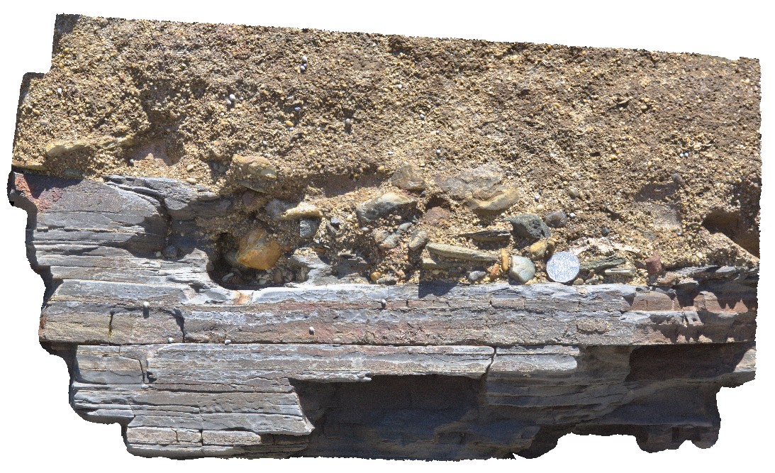
detailed view of geological unconformity between the Fossil Bluff Sandstone and underlying Permian rocks, showing irregular contact surface with large polymict cobbles in the Miocene rocks. Fossil Bluff Conservation Area, Wynyard. North Tasmania.
| Capture Date: | Undated |
| Latitude: | -40.98105000000 degrees |
| Longitude: | 145.73289000000 degrees |
| Elevation: | NA |
| Visualisation Type: | 3D |
| Location Accuracy: | 5 metres |
Keywords:
- unconformity
- geological contact
| sandstone | |
|---|---|
| Form Type: | bedded |
| Description: | coarse-grained sandstone, with cobble sized polymict clasts at base and in contact with Permian rocks. |
| Min Geological Age: | Early Miocene |
| Max Geological Age: | Early Miocene |
| Min Numerical Age: | 13.820 |
| Max Numerical Age: | 23.030 |
| Strat No: | 6846 |
| Supergroup: | |
| Group: | Table Cape Group |
| Subgroup: | |
| Formation: | Fossil Bluff Sandstone |
| Member: | |
| Province: | Bass Basin |
| sandstone | |
|---|---|
| Form Type: | bedded |
| Description: | thinly bedded sandstones and siltstones. |
| Min Geological Age: | Permian |
| Max Geological Age: | Late Carboniferous |
| Min Numerical Age: | 252.170 |
| Max Numerical Age: | 315.200 |
| Strat No: | 27023 |
| Supergroup: | Parmeener Supergroup |
| Group: | |
| Subgroup: | |
| Formation: | Wynyard Tillite |
| Member: | |
| Province: | Tasmania Basin |