NTasUAV1
Site:
NTasUAV1
Downloads:
Map
3D Model:
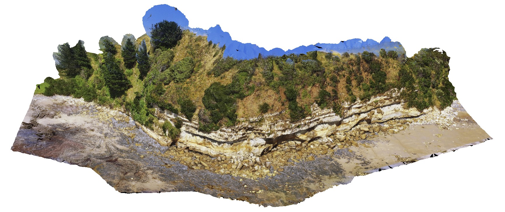
Description:
flat-lying sandstone beds of the Fossil Bluff Sandstone. Fossil Bluff Conservation Area, Wynyard. North Tasmania.
| Capture Date: | Undated |
| Latitude: | -40.98145800000 degrees |
| Longitude: | 145.73336400000 degrees |
| Elevation: | NA |
| Visualisation Type: | UAV |
| Location Accuracy: | 20 metres |
Keywords:
- sandstone
- bedding
| sandstone | |
|---|---|
| Form Type: | bedded |
| Description: | flat-lying thick sandstone beds. |
| Min Geological Age: | Early Miocene |
| Max Geological Age: | Early Miocene |
| Min Numerical Age: | 13.820 |
| Max Numerical Age: | 23.030 |
| Strat No: | 6846 |
| Supergroup: | |
| Group: | Table Cape Group |
| Subgroup: | |
| Formation: | Fossil Bluff Sandstone |
| Member: | |
| Province: | Bass Basin |