NTasUAV3
Site:
NTasUAV3
Downloads:
Map
3D Model:
Description:
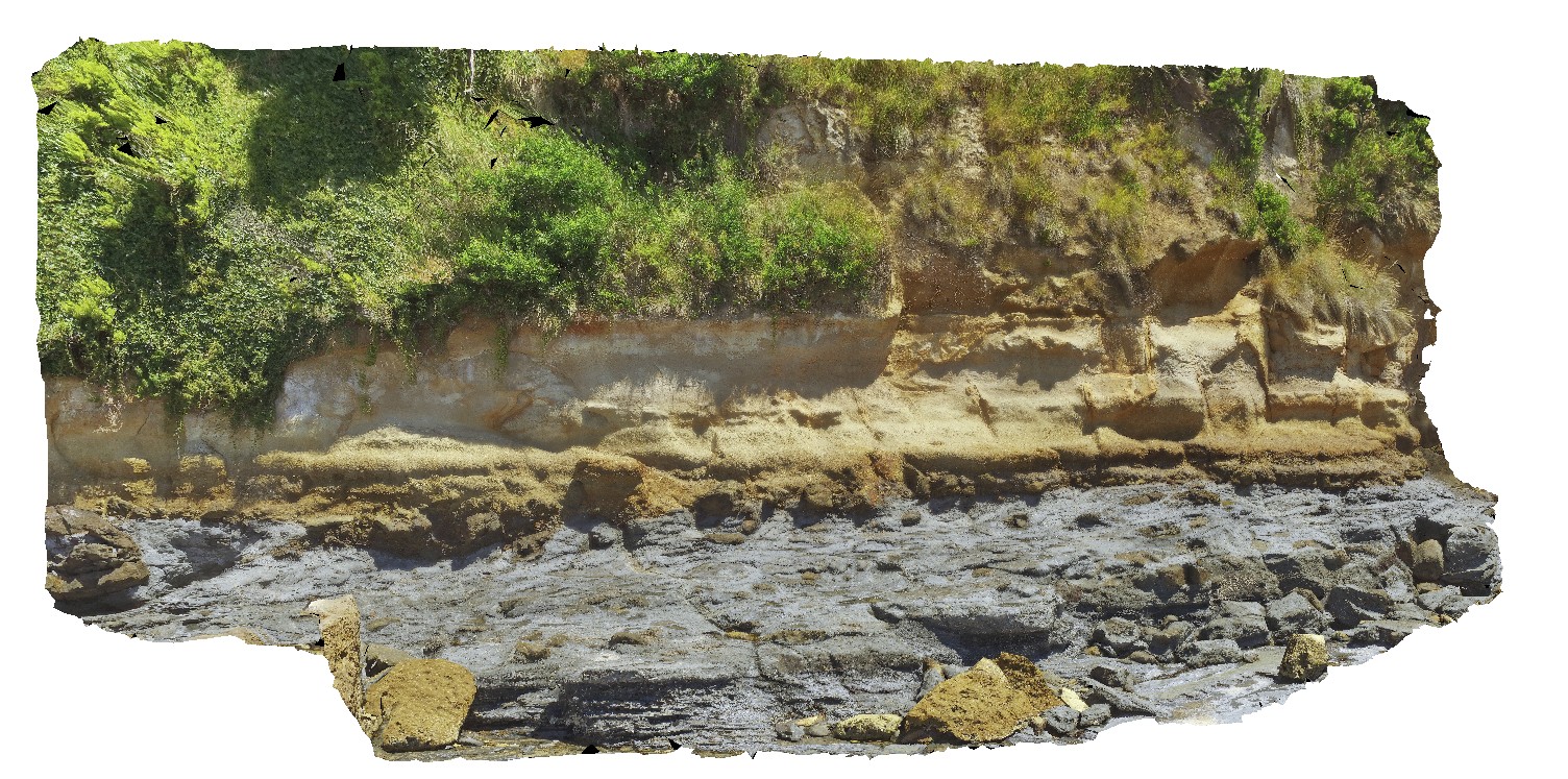
aerial view of the unconformity at the base of Fossil Bluff, between the Permian and Tertiary units. Fossil Bluff Conservation Area, Wynyard. North Tasmania.
| Capture Date: | Undated |
| Latitude: | -40.98138400000 degrees |
| Longitude: | 145.73309700000 degrees |
| Elevation: | NA |
| Visualisation Type: | UAV |
| Location Accuracy: | 20 metres |
Keywords:
- unconformity
- geological contact
- Fossil bluff
| sandstone | |
|---|---|
| Form Type: | bedded |
| Description: | thickly bedded, gritty to pebbly sandstone. |
| Min Geological Age: | Early Miocene |
| Max Geological Age: | Early Miocene |
| Min Numerical Age: | 13.820 |
| Max Numerical Age: | 23.030 |
| Strat No: | 6846 |
| Supergroup: | |
| Group: | Table Cape Group |
| Subgroup: | |
| Formation: | Fossil Bluff Sandstone |
| Member: | |
| Province: | Bass Basin |
| tillite | |
|---|---|
| Form Type: | bedded |
| Description: | grey, polymict tillite, with cobble to boulder sized erratics in sandy / silty matrix. |
| Min Geological Age: | Permian |
| Max Geological Age: | Late Carboniferous |
| Min Numerical Age: | 254.140 |
| Max Numerical Age: | 323.200 |
| Strat No: | 27023 |
| Supergroup: | Parmeener Supergroup |
| Group: | |
| Subgroup: | |
| Formation: | Wynyard Tillite |
| Member: | |
| Province: | Tasmania Basin |