NambuccaUAV1
Site:
NambuccaUAV1
Downloads:
Map
3D Model:
Description:
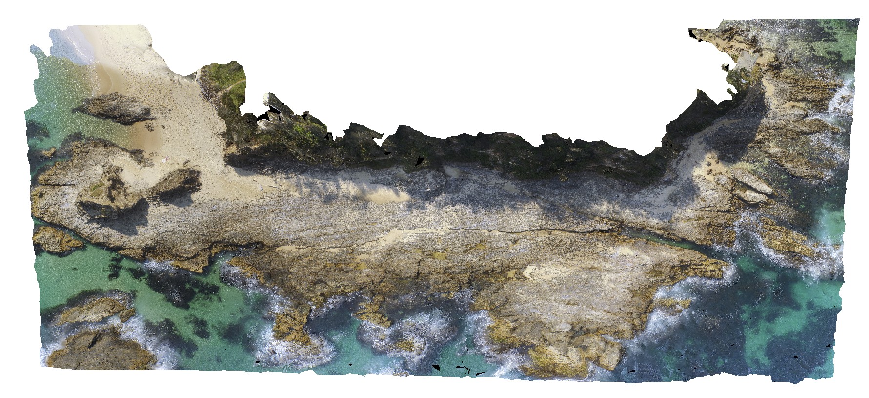
view of shoreline exposure, showing folded 'phyllite' of the Permo-Carboniferous Nambucca Beds. Nambucca, N.S.W.
| Capture Date: | April 18, 2016, 11:50 a.m. |
| Latitude: | -30.64857000000 degrees |
| Longitude: | 153.01886000000 degrees |
| Elevation: | NA |
| Visualisation Type: | UAV |
| Location Accuracy: | 5 metres |
Keywords:
- phyllite
- metamorphic
| phyllite | |
|---|---|
| Form Type: | |
| Description: | Slate, phyllite, schist, lithofeldspathic sandstone, minor conglomerate. |
| Min Geological Age: | Early Permian |
| Max Geological Age: | Late Carboniferous |
| Min Numerical Age: | 272.000 |
| Max Numerical Age: | 315.000 |
| Strat No: | 29689 |
| Supergroup: | |
| Group: | Nambucca beds |
| Subgroup: | |
| Formation: | |
| Member: | |
| Province: |