NewcastleUAV2
Site:
NewcastleUAV2
Downloads:
Map
3D Model:
Description:
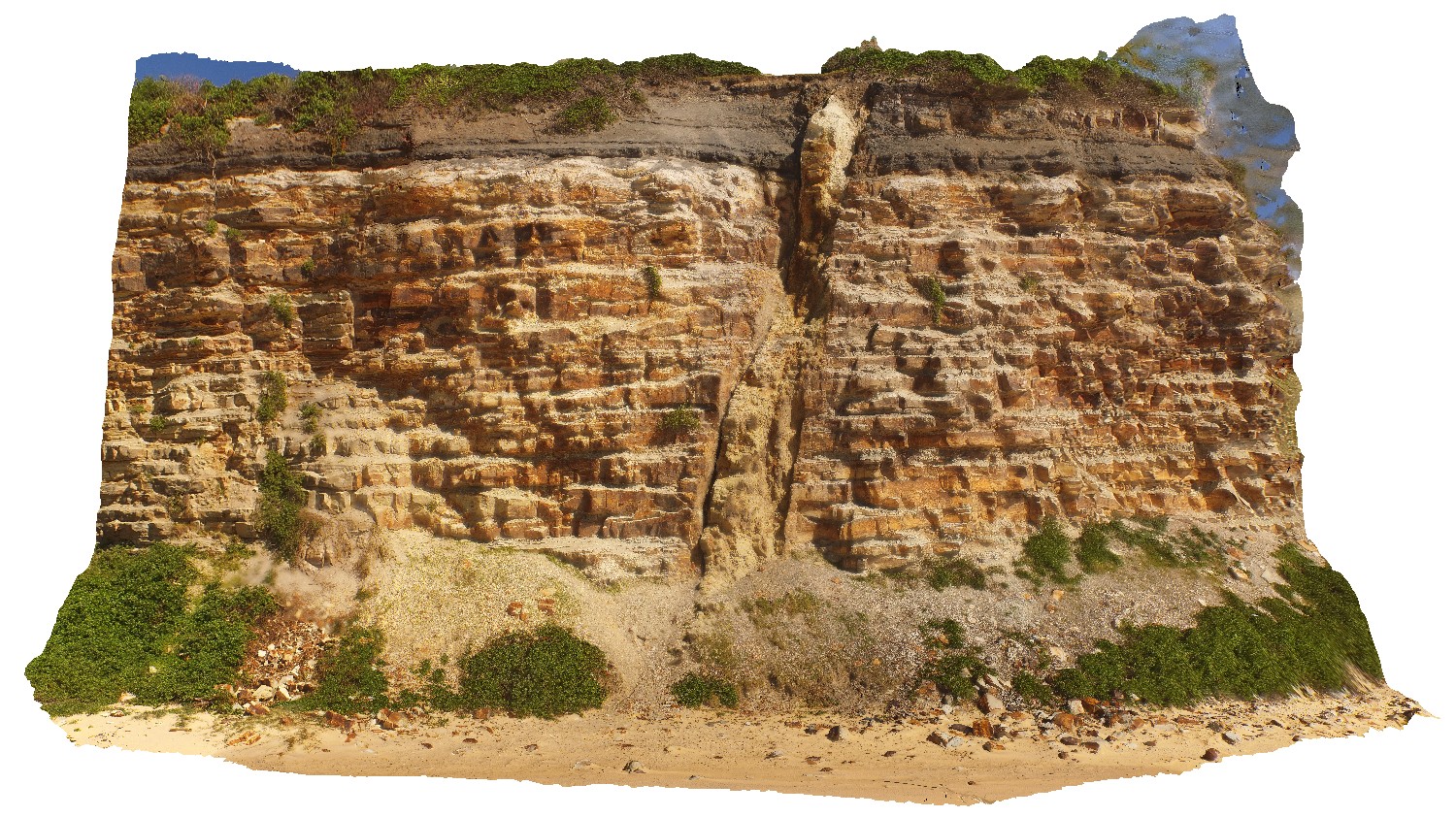
detail of dyke in Nobbys Headland, showing high to sub-vertical angle. Newcastle, N.S.W.
| Capture Date: | Undated |
| Latitude: | -32.91876700000 degrees |
| Longitude: | 151.79874000000 degrees |
| Elevation: | 15.400 metres |
| Visualisation Type: | UAV |
| Location Accuracy: | 20 metres |
Keywords:
- dyke
- igneous
| igneous rock | |
|---|---|
| Form Type: | dyke |
| Description: | fine-grained, pale coloured dyke. |
| Min Geological Age: | late Cretaceous |
| Max Geological Age: | late Cretaceous |
| Min Numerical Age: | 72.100 |
| Max Numerical Age: | 100.500 |
| Strat No: | 0 |
| Supergroup: | |
| Group: | |
| Subgroup: | |
| Formation: | |
| Member: | |
| Province: |