NewcastleUAV5
Site:
NewcastleUAV5
Downloads:
Map
3D Model:
Description:
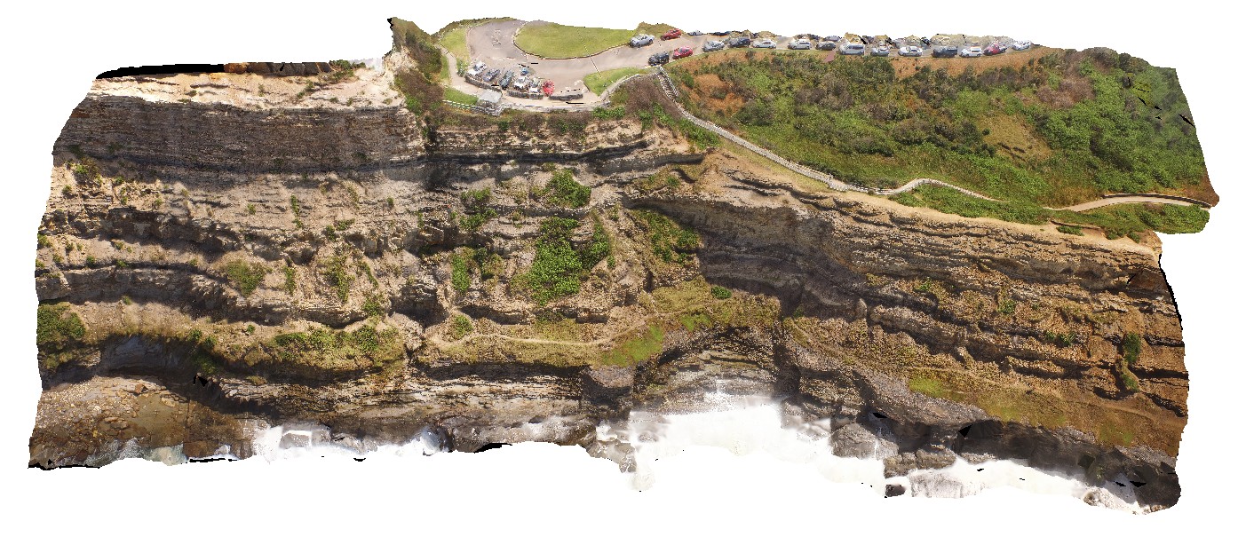
coastal cliff, south of the Bogey Hole. Newcastle, N.S.W.
| Capture Date: | Undated |
| Latitude: | -32.93545400000 degrees |
| Longitude: | 151.78061500000 degrees |
| Elevation: | 20.000 metres |
| Visualisation Type: | UAV |
| Location Accuracy: | 20 metres |
Keywords:
- sedimentology
- sediments
- tuff
- sandstone
| sediments | |
|---|---|
| Form Type: | bedded |
| Description: | bedded sandstones, mudstones? And siltstones. |
| Min Geological Age: | Late Permian |
| Max Geological Age: | Late Permian |
| Min Numerical Age: | 254.140 |
| Max Numerical Age: | 259.800 |
| Strat No: | 16939 |
| Supergroup: | Singleton Supergroup |
| Group: | |
| Subgroup: | |
| Formation: | |
| Member: | |
| Province: |