OLGA2
Site:
OLGA2
Downloads:
Map
3D Model:
Description:
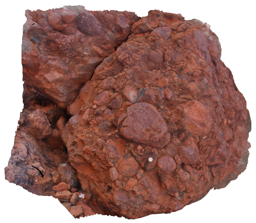
detailed view of polymict clasts in Mt Currie conglomerate at Kata Tjuta (The Olgas). Clasts are sub rounded, poorly sorted and matrix supported. Kata Tjuta National Park. N.T.
| Capture Date: | July 30, 2016, 10:38 a.m. |
| Latitude: | -25.30027200000 degrees |
| Longitude: | 130.72979700000 degrees |
| Elevation: | 620.020 metres |
| Visualisation Type: | 3D |
| Location Accuracy: | 0 metres |
Keywords:
- conglomerate
- Kata Tjuta
- Mt Currie conglomerate
- sedimentology
| conglomerate | |
|---|---|
| Form Type: | bedded |
| Description: | Conglomerate containing clasts of sandstone, quartzite, felsic and mafic volcanics, granite, gneiss, mafic intrusives. |
| Min Geological Age: | Cambrian |
| Max Geological Age: | Cambrian |
| Min Numerical Age: | 500.000 |
| Max Numerical Age: | 590.000 |
| Strat No: | 12609 |
| Supergroup: | |
| Group: | Pertaoorrta Group |
| Subgroup: | |
| Formation: | Mount Currie Conglomerate |
| Member: | |
| Province: | Amadeus Basin |