Olary10
Site:
Olary10
Downloads:
Map
3D Model:
Description:
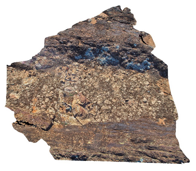
diamictite pavement, showing angular to sub-angular matrix supported clasts and other beds. Olary. S.A.
| Capture Date: | July 14, 2015, 10:39 a.m. |
| Latitude: | -32.09558000000 degrees |
| Longitude: | 140.27917000000 degrees |
| Elevation: | NA |
| Visualisation Type: | 3D |
| Location Accuracy: | 5 metres |
Keywords:
- diamictite
| diamictite | |
|---|---|
| Form Type: | bedded |
| Description: | glaciomarine diamictite with angular to sub-angular clasts in finer, sandy matrix. |
| Min Geological Age: | Cryogenian |
| Max Geological Age: | Cryogenian |
| Min Numerical Age: | 600.000 |
| Max Numerical Age: | 800.000 |
| Strat No: | 74092 |
| Supergroup: | Heysen Supergroup |
| Group: | |
| Subgroup: | |
| Formation: | |
| Member: | Old Boolcoomata Conglomerate Member |
| Province: |