Olary17
Site:
Olary17
Downloads:
Map
3D Model:
Description:
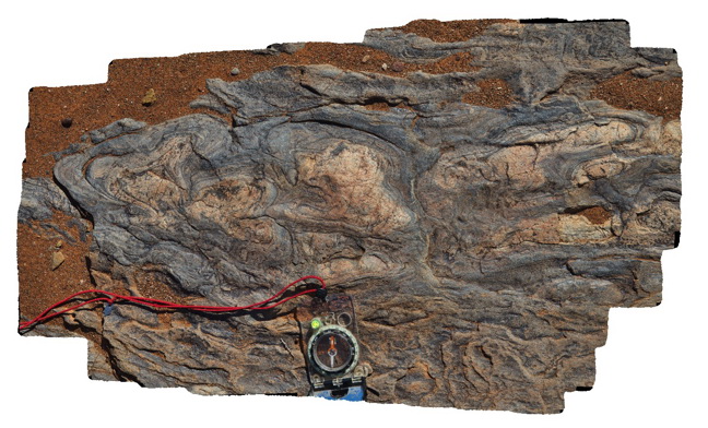
fold interference patterns / soft sediment deformation in finely layered sediments. Weekaroo, Olary, S.A.
| Capture Date: | July 14, 2015, 11:19 a.m. |
| Latitude: | -32.17105000000 degrees |
| Longitude: | 139.98546000000 degrees |
| Elevation: | NA |
| Visualisation Type: | 3D |
| Location Accuracy: | 5 metres |
Keywords:
- fold interference pattern
- soft sediment deformation
- metasediment
| psammite | |
|---|---|
| Form Type: | bedded |
| Description: | soft sediment deformation of finely layered psammite beds. |
| Min Geological Age: | Paleoproterozoic |
| Max Geological Age: | Paleoproterozoic |
| Min Numerical Age: | 1600.000 |
| Max Numerical Age: | 2500.000 |
| Strat No: | 68095 |
| Supergroup: | Willyama Supergroup |
| Group: | |
| Subgroup: | |
| Formation: | Walparuta Formation |
| Member: | |
| Province: |