Olary36
Site:
Olary36
Downloads:
Map
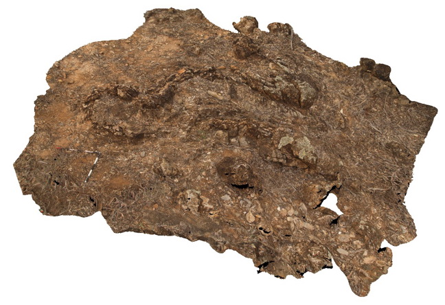
3D Model:
Description:
view of a refolded fold in calcareous mudstone and sandstones. Weekaroo, Olary. S.A.
| Capture Date: | July 14, 2015, 11:31 a.m. |
| Latitude: | -32.19386000000 degrees |
| Longitude: | 139.95740000000 degrees |
| Elevation: | NA |
| Visualisation Type: | 3D |
| Location Accuracy: | 5 metres |
Keywords:
- refolded fold
- fold
- structure
| sandstone | |
|---|---|
| Form Type: | bedded |
| Description: | unit and age unknown. Highly deformed metasedimentary and meta-igneous schists and gneisses and minor 'lode' rocks. |
| Min Geological Age: | Statherian |
| Max Geological Age: | Statherian |
| Min Numerical Age: | 1640.000 |
| Max Numerical Age: | 1730.000 |
| Strat No: | 20135 |
| Supergroup: | Willyama Supergroup |
| Group: | |
| Subgroup: | |
| Formation: | |
| Member: | |
| Province: | Curnamona Province |