Olary37
Site:
Olary37
Downloads:
Map
3D Model:
Description:
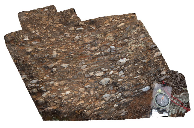
view of orientated fabric (pebbles) in the core of F2 fold in conglomerate band. Related to image Olary36. Weekaroo. Olary, S.A.
| Capture Date: | July 14, 2015, 11:33 a.m. |
| Latitude: | -32.19503000000 degrees |
| Longitude: | 139.95515000000 degrees |
| Elevation: | NA |
| Visualisation Type: | 3D |
| Location Accuracy: | 5 metres |
Keywords:
- F2 fold
- structural fabric
- fold
| conglomerate | |
|---|---|
| Form Type: | bedded |
| Description: | age and unit unknown |
| Min Geological Age: | Statherian |
| Max Geological Age: | Statherian |
| Min Numerical Age: | 1640.000 |
| Max Numerical Age: | 1730.000 |
| Strat No: | 20135 |
| Supergroup: | Willyama Supergroup |
| Group: | |
| Subgroup: | |
| Formation: | |
| Member: | |
| Province: | Curnamona Province |