Olary54
Site:
Olary54
Downloads:
Map
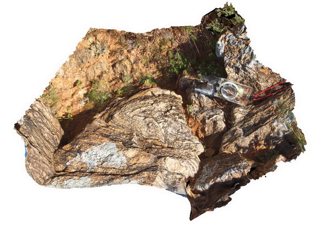
3D Model:
Description:
recumbent F2? fold, folding migmatised pelitic metasediments. Olary, S.A.
| Capture Date: | Sept. 27, 2015, 6:29 p.m. |
| Latitude: | -32.05655000000 degrees |
| Longitude: | 140.41499000000 degrees |
| Elevation: | NA |
| Visualisation Type: | 3D |
| Location Accuracy: | 0 metres |
Keywords:
- recumbent fold
- migmatite
- structure
| metasediments | |
|---|---|
| Form Type: | bedded |
| Description: | Highly deformed metasedimentary and meta-igneous schists and gneisses and minor 'lode' rocks. |
| Min Geological Age: | Statherian |
| Max Geological Age: | Statherian |
| Min Numerical Age: | 1640.000 |
| Max Numerical Age: | 1730.000 |
| Strat No: | 20135 |
| Supergroup: | Willyama Supergroup |
| Group: | |
| Subgroup: | |
| Formation: | |
| Member: | |
| Province: | Curnamona Province |