Olary59
Site:
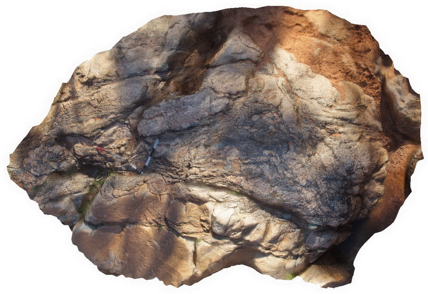
Olary59
Downloads:
Map
3D Model:
Description:
migmatised raft of folded pelite metasediments in Basso Granite. Olary, S.A.
| Capture Date: | Sept. 27, 2015, 6:31 p.m. |
| Latitude: | -32.11266000000 degrees |
| Longitude: | 140.30937000000 degrees |
| Elevation: | NA |
| Visualisation Type: | 3D |
| Location Accuracy: | 0 metres |
Keywords:
| metagranite | |
|---|---|
| Form Type: | |
| Description: | Granofels, albitic; granite gneiss; derived from felsic volcanic rock and granite; generally Na-altered; A-type. |
| Min Geological Age: | Statherian |
| Max Geological Age: | Statherian |
| Min Numerical Age: | 1699.000 |
| Max Numerical Age: | 1712.000 |
| Strat No: | 35879 |
| Supergroup: | |
| Group: | Basso Suite |
| Subgroup: | |
| Formation: | |
| Member: | |
| Province: |