OlaryFSP1
Site:
OlaryFSP1
Downloads:
Map
Description:
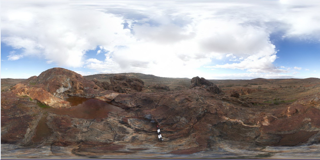
3D view from Cathedral Rock, showing green (Amphibole?) veins and pegmatite dyke cross cutting metasediments. Olary. S.A.
| Capture Date: | July 14, 2015, 11:38 a.m. |
| Latitude: | -32.09031000000 degrees |
| Longitude: | 140.31964000000 degrees |
| Elevation: | NA |
| Visualisation Type: | FSP |
| Location Accuracy: | 0 metres |
Keywords:
- mineral vein
- pegmatite dyke
- metasediments
- structure
| metasediments | |
|---|---|
| Form Type: | bedded |
| Description: | Well-bedded, pelitic sediments with calc-silicate rocks. |
| Min Geological Age: | Statherian |
| Max Geological Age: | Statherian |
| Min Numerical Age: | 1708.000 |
| Max Numerical Age: | 1711.500 |
| Strat No: | 35883 |
| Supergroup: | Willyama Supergroup |
| Group: | |
| Subgroup: | Ethiudna Subgroup |
| Formation: | |
| Member: | |
| Province: |
| pegmatite | |
|---|---|
| Form Type: | dyke |
| Description: | felsic pegmatite dyke. Age unknown |
| Min Geological Age: | |
| Max Geological Age: | |
| Min Numerical Age: | 0.000 |
| Max Numerical Age: | 0.000 |
| Strat No: | 0 |
| Supergroup: | |
| Group: | |
| Subgroup: | |
| Formation: | |
| Member: | |
| Province: |