OlaryPole1
Site:
OlaryPole1
Downloads:
Map
Description:
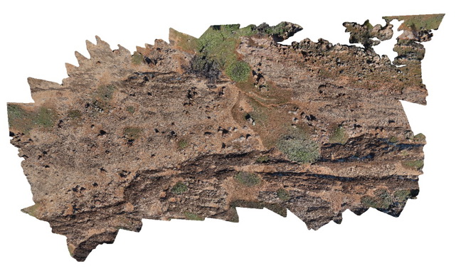
view form pole of conglomerate / diamictite and interbedded sediment package, showing bedding horizons. Near Old Boolcoomata Homestead. Olary, S.A.
| Capture Date: | Nov. 3, 2015, 1:24 p.m. |
| Latitude: | -32.09571000000 degrees |
| Longitude: | 140.27974000000 degrees |
| Elevation: | 305.000 metres |
| Visualisation Type: | 3D |
| Location Accuracy: | 0 metres |
Keywords:
- diamictite
| diamictite | |
|---|---|
| Form Type: | bedded |
| Description: | Diamictite; siltstone; pebbly dolomite; orthoquartzite; glaciomarine |
| Min Geological Age: | Cryogenian |
| Max Geological Age: | Cryogenian |
| Min Numerical Age: | 600.000 |
| Max Numerical Age: | 800.000 |
| Strat No: | 74092 |
| Supergroup: | Heysen Supergroup Heysen Supergroup |
| Group: | |
| Subgroup: | |
| Formation: | |
| Member: | Old Boolcoomata Conglomerate Member |
| Province: |