OlaryUAV2
Site:
OlaryUAV2
Downloads:
Map
3D Model:
Description:
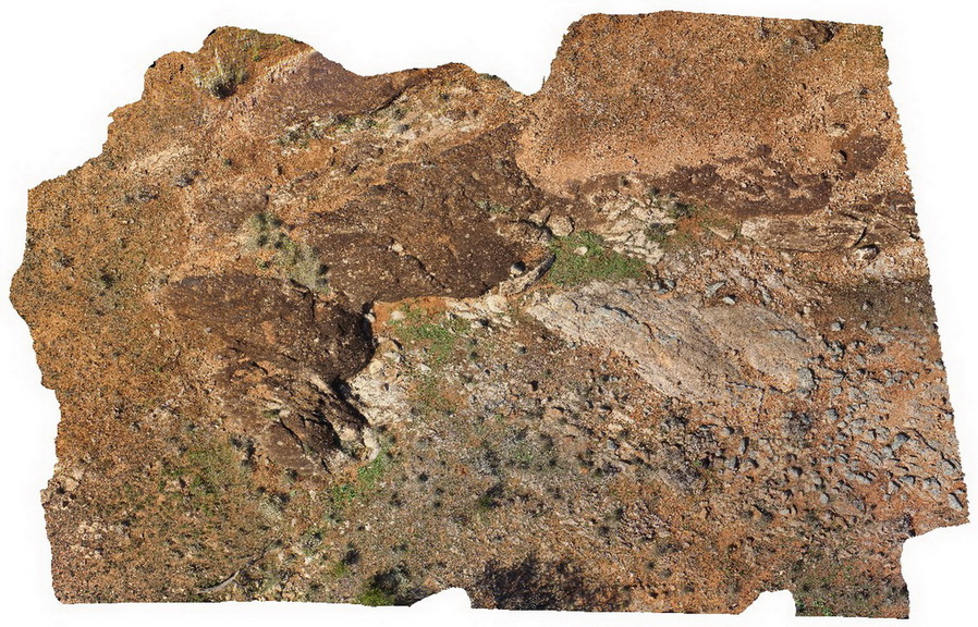
aerial view of Old Boolcoomata Conglomerate Member, showing interbedded conglomerate with pebbly sandstone and siltstone. Old Boolcoomata Station. Olary. S.A.
| Capture Date: | Sept. 27, 2015, 6:50 p.m. |
| Latitude: | -32.09433000000 degrees |
| Longitude: | 140.27747000000 degrees |
| Elevation: | NA |
| Visualisation Type: | UAV |
| Location Accuracy: | 0 metres |
Keywords:
- conglomerate
- sedimentology
| conglomerate | |
|---|---|
| Form Type: | bedded |
| Description: | glacial conglomerate and associated deposits. |
| Min Geological Age: | Cryogenian |
| Max Geological Age: | Cryogenian |
| Min Numerical Age: | 600.000 |
| Max Numerical Age: | 800.000 |
| Strat No: | 74092 |
| Supergroup: | Heysen Supergroup |
| Group: | |
| Subgroup: | |
| Formation: | |
| Member: | Old Boolcoomata Conglomerate Member |
| Province: |