ParkersUAV2
Site:
ParkersUAV2
Downloads:
Map
3D Model:
Description:
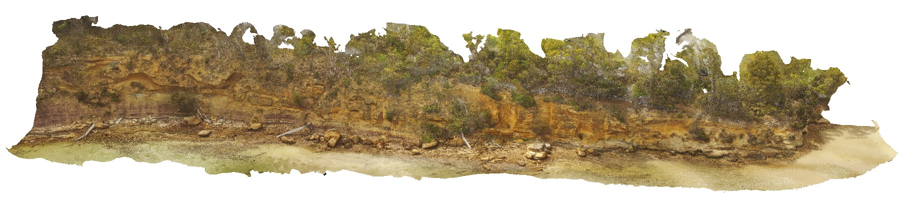
detailed view of Triassic fluvial and flood plain sediments. Parkers Beach, Nubeena Tasmania.
| Capture Date: | Undated |
| Latitude: | -43.04860200000 degrees |
| Longitude: | 147.79403500000 degrees |
| Elevation: | 26.000 metres |
| Visualisation Type: | UAV |
| Location Accuracy: | 20 metres |
Keywords:
- Triassic
- fluvial
- floodplain
- sedimentology
| sandstone | |
|---|---|
| Form Type: | bedded |
| Description: | Late Permian to Triassic sandstone. Medium-grained fluvial and floodplain stratigraphy. |
| Min Geological Age: | Late Triassic |
| Max Geological Age: | Capitanian |
| Min Numerical Age: | 214.000 |
| Max Numerical Age: | 265.100 |
| Strat No: | 68522 |
| Supergroup: | Parmeener Supergroup |
| Group: | |
| Subgroup: | |
| Formation: | |
| Member: | |
| Province: | Melbourne-Mathinna Zone |