Pennington5
Site:
Pennington5
Downloads:
Map
3D Model:
Description:
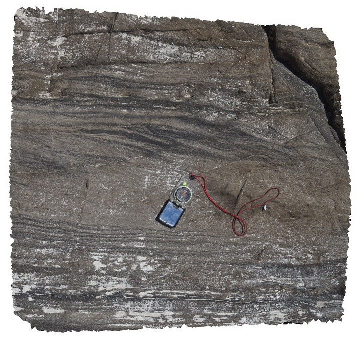
detail of planar and cross-laminations in Petrel Cove sandstone beds. Pennington Bay, Kangaroo Island.
| Capture Date: | Oct. 20, 2015, 3:33 p.m. |
| Latitude: | -35.85093000000 degrees |
| Longitude: | 137.73552000000 degrees |
| Elevation: | NA |
| Visualisation Type: | 3D |
| Location Accuracy: | 0 metres |
Keywords:
- cross-laminations
- sandstone
- laminations
| sandstone | |
|---|---|
| Form Type: | bedded |
| Description: | Grey-black Bouma-like sandstone-mudstone couplets. Planar-bedded, fine- to medium-grained sandstone grading up to small-scale ripple x-laminated sandstone, siltstone and mudstone. |
| Min Geological Age: | Middle Cambrian |
| Max Geological Age: | Early Cambrian |
| Min Numerical Age: | 497.000 |
| Max Numerical Age: | 541.000 |
| Strat No: | 15122 |
| Supergroup: | Moralana Supergroup |
| Group: | |
| Subgroup: | |
| Formation: | Petrel Cove Formation |
| Member: | |
| Province: | Delamerian Orogen, Stansbury Basin |